|
|
Post by pjw4118 on Mar 3, 2017 12:24:44 GMT 12
DAve, Here's a google earth shot before the runway wattles were taken down. 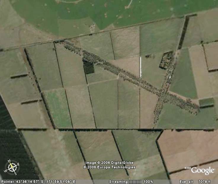  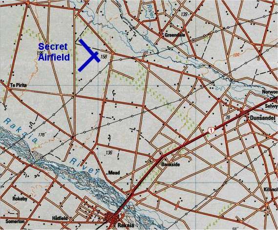 and Bruce I think this is the location of Strathmore. Not yet ground checked yet 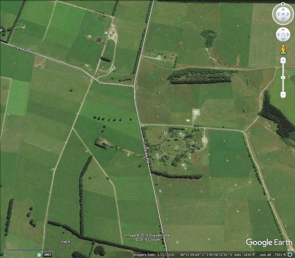 |
|
|
|
Post by Dave Homewood on Mar 3, 2017 12:37:22 GMT 12
Thanks Peter.
|
|
|
|
Post by pjw4118 on May 17, 2018 13:44:34 GMT 12
Over Easter I had a look around Reparoa and met a local historian who pointed out the site of the Strathmore camp in Anzio Road , google earth 38.29.01.39 and 176. 20.26.86 where the house is. There is nothing there except a block or two .
Earlier I had checked on Bruces site for Strathmore but that was a Landcorp farm village , however it did have some very impressive satellite dishes and domes , apparently part of a GPS system.
None of the locals new of a wartime aerodrome so Davids Galatea may be the only one in central NI.
|
|
|
|
Post by TS on May 17, 2018 14:56:43 GMT 12
Well for what this might be worth... If you draw a line up from Rakaia to Hororata on Google. Then off to the right at approximately halfway up there appears to be what's left of a very distinctive runway shape.  |
|
|
|
Post by Bruce on May 17, 2018 17:57:27 GMT 12
Well for what this might be worth... If you draw a line up from Rakaia to Hororata on Google. Then off to the right at approximately halfway up there appears to be what's left of a very distinctive runway shape. Thats Te Pirita, a large bomber dispersal base constructed in WW2. The Fuel depot at Bankside is associated with it. Use the history control on Google Earth to see what it looked like in 2004, before it was largely destroyed by the installation of centre-pivot irrigators. ( criminal destruction in my book...) The runways were covered in Wattle trees until recently as the soil used as fill was contaminated by seeds!. Theres a number of dispersal rivetments parallel to the road on the North west side. |
|
|
|
Post by davidd on May 17, 2018 23:27:54 GMT 12
Bruce,
So far as I can see, the Bankside Reserve Fuel tank actually has no connection with the Te Pirita airfield, which had its own storage tanks, although nothing on the scale of Bankside. I had a good read of the RNZAF file on Te Pirita, including the original survey report written by F/L A J Bradshaw, and there seemed to be no consideration given to a large supply of fuel held locally. However the airfield had, from memory, two or three 11,000 Imperial gallon underground tanks of its own for the purpose. As the role of this airfield was to serve as a dispersal area for B-17s, etc, the fuel supplies held near the field were probably adequate to top up the tanks of the resident American bombers prior to their returning to Ohakea or Whenuapai, which is where they would have come from in the first place. Te Pirita was never envisaged as a base for launching operational attacks against the Japanese, and in case of emergency they would have been manned by minimal staff sufficient for the job of refuelling and looking after any aircrafts sent here until word came though that it was safe to return to the main airfields in the North Island.
David D
|
|
|
|
Post by Dave Homewood on May 18, 2018 8:03:58 GMT 12
That makes sense David considering there was no infrastructure there to support operational flying, such as bomb dumps, workshops, mess halls, etc. Cheers.
|
|
flymac
Pilot Officer

Posts: 45 
|
Post by flymac on May 18, 2018 8:38:35 GMT 12
Looking carefully at Peter's 'secret airfield' map posting above I spotted on the RHS the location of Norwood.
Is that the Norwood Training Airfield which was part of the Wigram training establishment?
|
|