|
|
Post by Bruce on Dec 28, 2006 22:23:55 GMT 12
I have recently installed Google Earth on my home PC, which is really good but chews up the internet traffic! Curiousity caused me to have a look at Waipapakauri to see what was left: 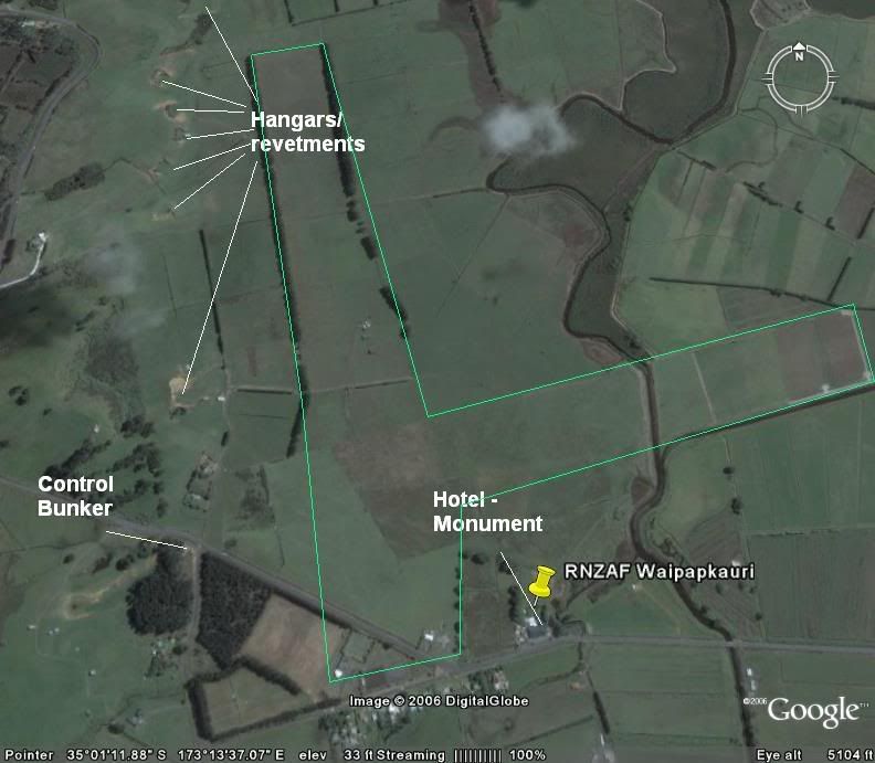 I have added some pointers to stuff I have noted (looks good zoomed in even further than this) The green outline I have added shows the approximate runway layout. Note the curve in the road currently cuts across the corner of the airfield. The remains of at least 7 hangars / revetments can be seen. remaining surface structures are the Hotel (former base HQ and Hospital) and the command control bunker. Note that fencelines and hedgerows roughly follow the airfield layout. Will need to get up there and do a proper survey sometime.... |
|
|
|
Post by steve on Dec 28, 2006 23:10:43 GMT 12
Really very impressive...have spent some time up there looking for revetments but found private propert signs etc. The control bunker was one of the few built above ground because of water problems.
|
|
|
|
Post by Dave Homewood on Dec 28, 2006 23:29:59 GMT 12
Is that a stream or a drain crossing the runway on the right? Or just a later-installed hedge?
It meanders like a stream.
|
|
|
|
Post by Bruce on Dec 29, 2006 8:17:28 GMT 12
It is a stream - there was a culvert installed across it where the runway crossed over - notice that the stream is straight at this point. The culvert was probably removed after the airfield closed as a result of flooding - Its pretty low lying, swampy ground.
Where the two farmhouses are now located west of the runway intersection is possibly another hangar site. The domestic areas were small, dispersed camps located to the Southwest of the control bunker and along the ridgenear the road north on the right of the picture - although this is fortunately in a part of Google earth with high res images, I cant make out anything in these areas.
|
|