|
|
Post by aeromedia on Jul 19, 2011 18:39:54 GMT 12
Ahh, went back to page one and yes by the map, that adds up where I was, Fighter 1 with the Blue Holes.
Now regarding this:
On Santo there is the remains of a crashed B17 and an Avenger that are easy to find.
It may well have been an Avenger I climbed into a hole to see. I remember it being an aircraft about that size, but was fairly crushed up and awkward to assess. Can anyone confirm that the Avenger mentioned above was in a hole/dump near off to the side of Fighter 1 ? It was, after all, fairly easy to find? Locals had cut bits of metal out of it over the years, but there was plenty left really.
|
|
|
|
Post by Peter Lewis on Jul 19, 2011 20:12:39 GMT 12
what? you are only up to your knee's and you need a life jacket? As I said early, despite being a Pisces, I'm not all that keen on salt water unless its outside the boat/plane. Anyway, to continue, we soared aloft in the Buccaneer and had a look around Efate, the main island. First up, Quion Hill airstrip. This is on the north-western coast of Efate. Easily accessible by road or plane. Built adjunct to the large US base at Havannah Harbour. From "Building the Navy's Bases in World War II [Chapter 24] page 205": "Near Quoin Hill, on the northeastern corner of the island a site was chosen for a bomber strip in an area of hot springs. The work on the 6,000-by-200-foot runway was begun early in October (1942) and was completed by the middle of January 1943." From pacificwrecks.com: "Located on the north coast, near the center of Efaté Island. Also known as Quine Hill Airstrip. Today It is overgrown and disused since the war, aside from occasional landings by light aircraft only". Joining for the downwind. Quion Hill itself is to the left in the photo looking inland 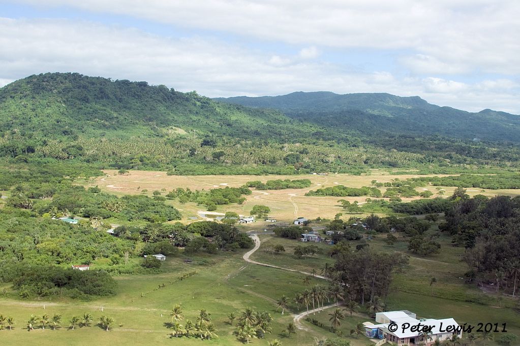 Turning final 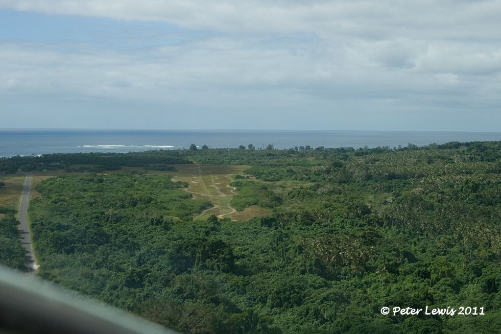 Short finals 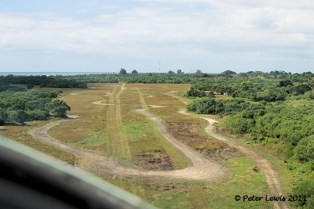 On the ground little remains apart from a number of loose-metal tracks that look as if they are used by the local ton-up boys. A brief search failed to uncover any concrete/sealed areas. There is a radio mast, presumably still in use, at the northern end 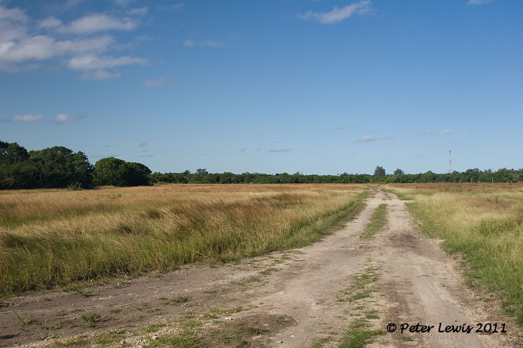 |
|
|
|
Post by Dave Homewood on Jul 19, 2011 20:51:33 GMT 12
Very neat phoots. Did any NZ units ever operate from there?
|
|
|
|
Post by stu on Jul 20, 2011 16:09:42 GMT 12
|
|
|
|
Post by Dave Homewood on Jul 20, 2011 16:25:58 GMT 12
|
|
|
|
Post by Peter Lewis on Jul 20, 2011 18:15:59 GMT 12
Departing Quoin, take a wide circuit out over the sea and look back at the coast. There are extensive mangrove swamps in this area 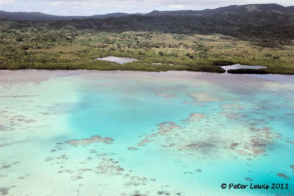 This is the spot where two US Navy F4U-1 Corsair aircraft splashed in on 5May1944 after running out of fuel just short of landing at Quion Hill airfield. The Corsair Bu02270 flown by 2nd Lt. James A. Vittitoe was beached right on the shoreline. After being a tourist attraction for many years, the wreck was sold to a group from Classic Jets Museum, near Adelaide, South Australia, in about 2009 and removed. However, a second Corsair ditched behind him, and was totally submerged. It is still there. Can you see it? 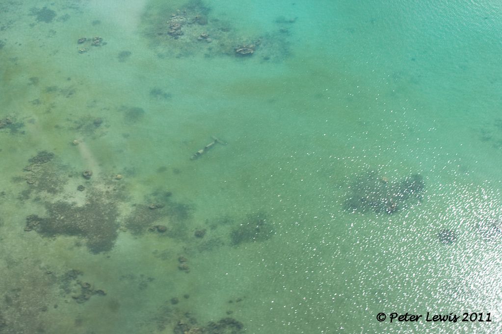 There it is! 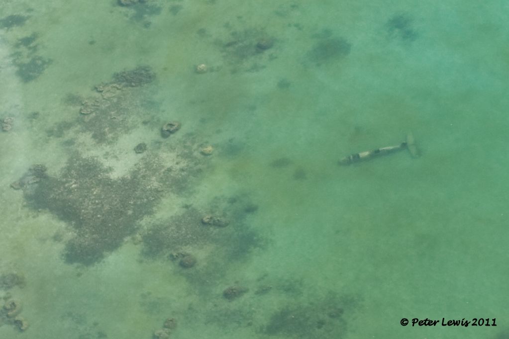 Surprisingly, I have been unable to find the identity or much detail on this second Corsair. Does anyone know? There is a small museum inland from this location, occupying part of the old US military camp. It holds a few relics, and does allow you to swim out to the submerged wreck. However, as I am a reluctant swimmer I declined the invitation. They charge 500vt (about NZD7.00) to view the relics, which is a bit over the top for what they offer. I was able to find a wartime chart there that confirmed the location of the Vila harbour seaplane base so I was not too unhappy. 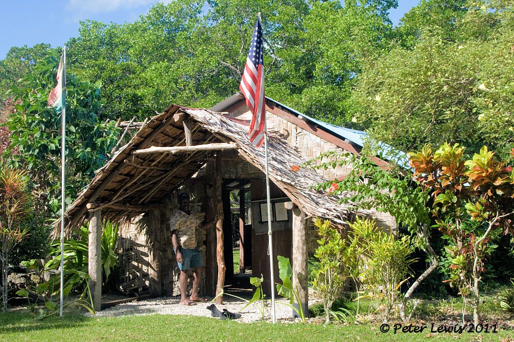 |
|
|
|
Post by Dave Homewood on Jul 20, 2011 21:48:54 GMT 12
Peter, I don't know if this helps any but it is a wartime Corsair pilot's map of Santo, showing the seaplane base.   |
|
|
|
Post by Radialicious on Jul 21, 2011 0:31:03 GMT 12
I was in Port Vila on Monday. We flew in from Brisbane and shared the air with an old friend a long way from home. 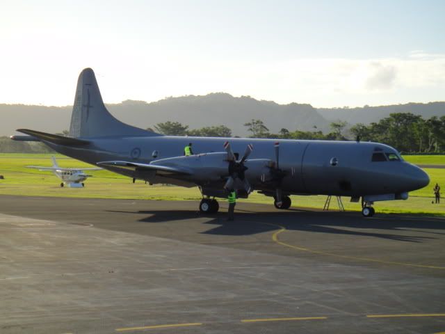 Port Vila is a very popular overnight for us as it is one of the most tropical escapes from a Christchurch winter. |
|
|
|
Post by Radialicious on Jul 21, 2011 0:35:18 GMT 12
Grouse photos Peter, I'll have to get a bit more adventurous next time I have an extended layover in Port Vila.
|
|
|
|
Post by Peter Lewis on Jul 21, 2011 20:39:54 GMT 12
Thanks Dave, yes every little helps. May I reproduce those elsewhere? Next stop along the Efate coast from Quoin is Havannah Harbour. This estuary is extensive, and was the logical choice for a sizeable US Naval presence starting in 1942. From Building the Navy's Bases in World War II: "members of the detachment rushed construction of a seaplane base at Havannah Harbor to serve a squadron of PBY's. The Seabees built two ramps of coral, surfaced with wire mesh, and provided buoys for mooring 14 seaplanes. By June 1, the PBY's began operating from the new base, bombing the Japanese positions on Guadalcanal. In addition to the ramps and moorings, two small piers, two nose hangars, one 40-by-100-foot seaplane workshop, four 5,000-gallon underground gasoline tanks, and housing facilities for 25 officers and 210 men in quonset huts were constructed." The seaway used by the aircraft is at the far right of this photo (looking west) against the side of Moso Island. 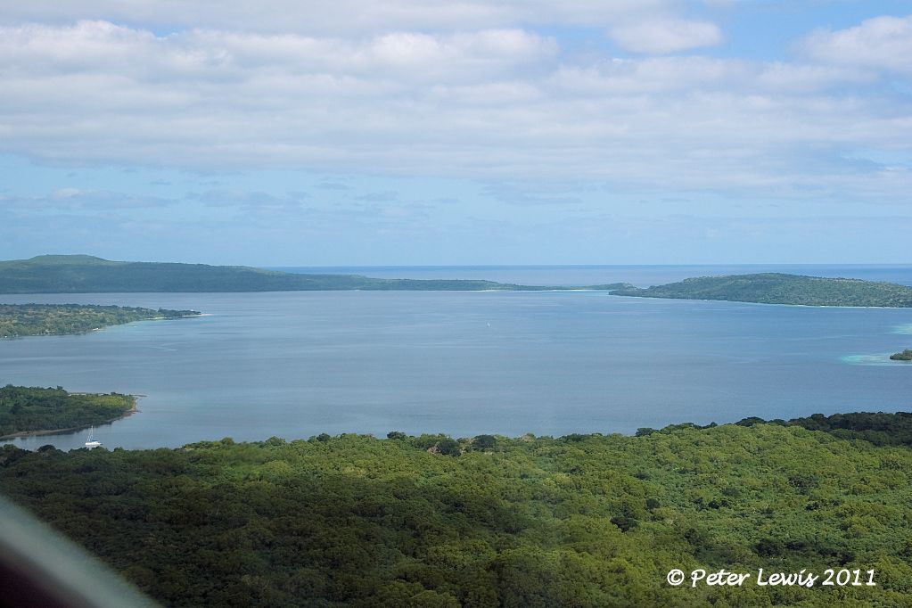 The moorings and launching ramps were located down the mainland coast, adjacent to what is now the main road, now looking east 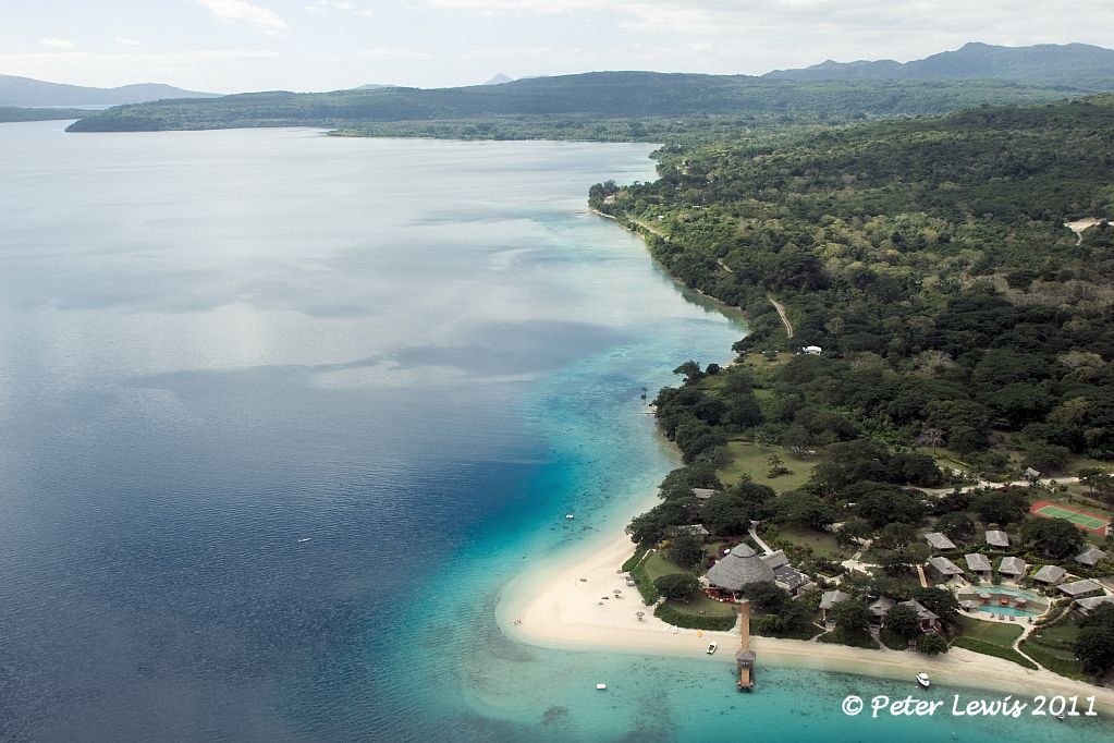 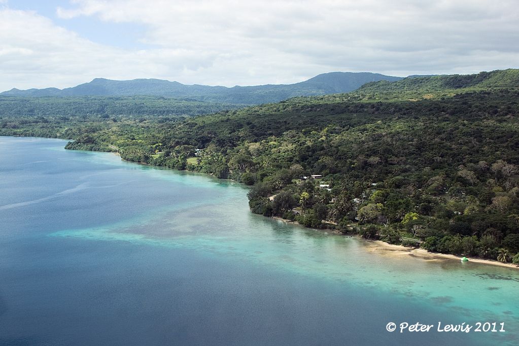 Later in the war, this area was a rear area and staging point for thousands of American troops for their R&R. Little remains on the ground. However, there is a small museum set up on the roadside where a few artifacts are displayed for public viewing 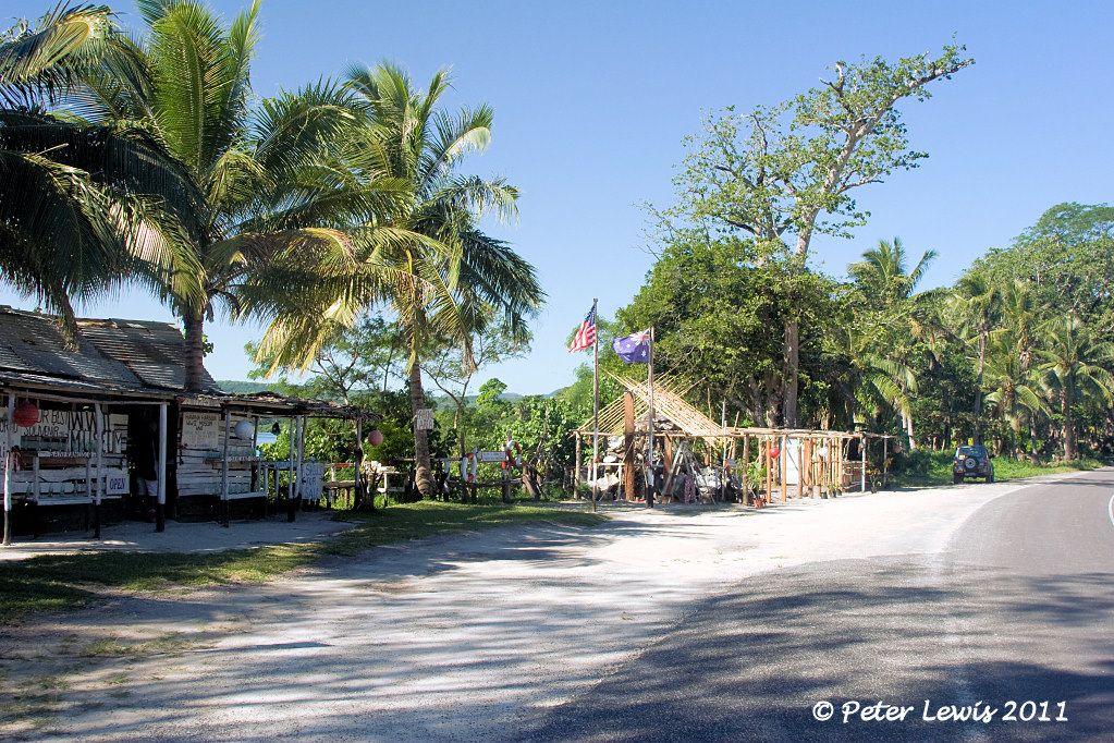 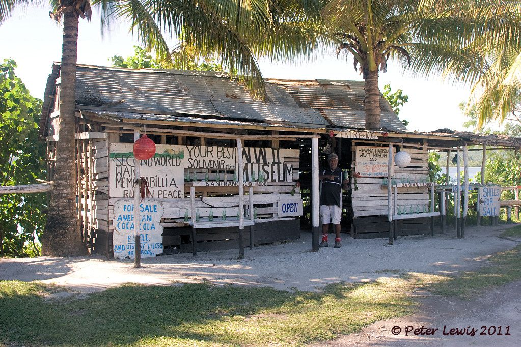 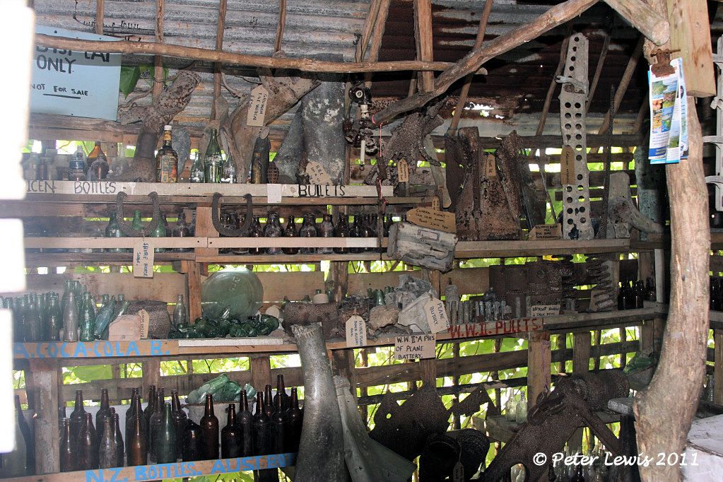 After dipping the keel in the harbour as a sulute to the oldtimers, we climb away from the coastline at Havannah Harbour, the old fighter strip up in the hills still evident on the ridgeline 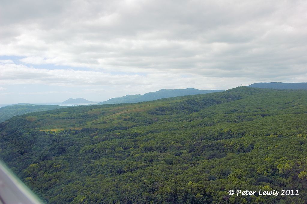 Building the Navy's Bases in World War II Building the Navy's Bases in World War II says: "A 3,000-by-180-foot fighter strip was also built at Port Havannah in the early fall of 1942. Fighters were able to land 26 days after construction began, and in another 15 days the field was completed. Two nose hangars were also erected. " Little remains to be seen on the site today, as this strip has not been used since 1945 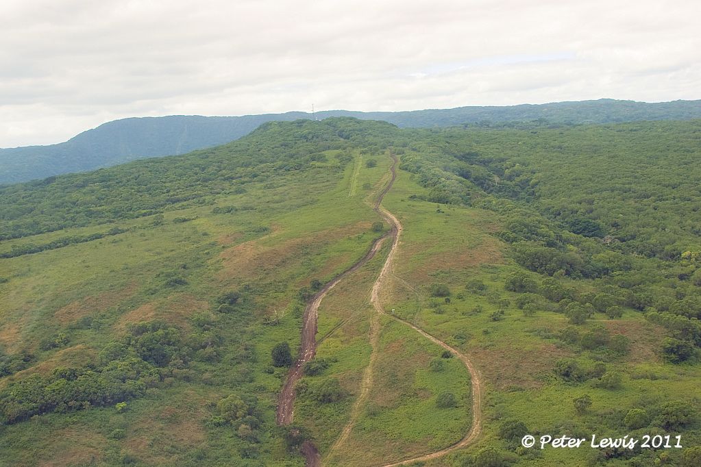 |
|
|
|
Post by Dave Homewood on Jul 21, 2011 21:02:30 GMT 12
Feel free to use my photo of the map, I don't think it is classified any more.
In that first photo, is that looking towards Aore Island on the right and Bocacio Island on the left?
|
|
|
|
Post by Peter Lewis on Jul 21, 2011 22:25:34 GMT 12
Thanks. No, this is Havannah harbour on Efate. We haven't got to Santo yet. Santo is 280km to the North. That's Moso Island on the right and the Efate mainland on the left, plane flying in a westerly direction.  |
|
|
|
Post by Dave Homewood on Jul 21, 2011 22:57:55 GMT 12
Ah right, I understand now. So was that airfield you visited the Vila airfield known by the codeword "Roses"? If yes, our squadrons did use it.
|
|
|
|
Post by Peter Lewis on Jul 22, 2011 18:41:08 GMT 12
Tracking back down the west coast, we come next to the airport of Efate, Bauerfield International. 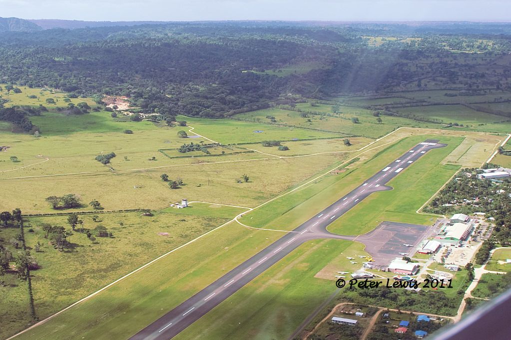 Currently this is a 8500ft strip capable of handling aircraft up to 737/A320 standard 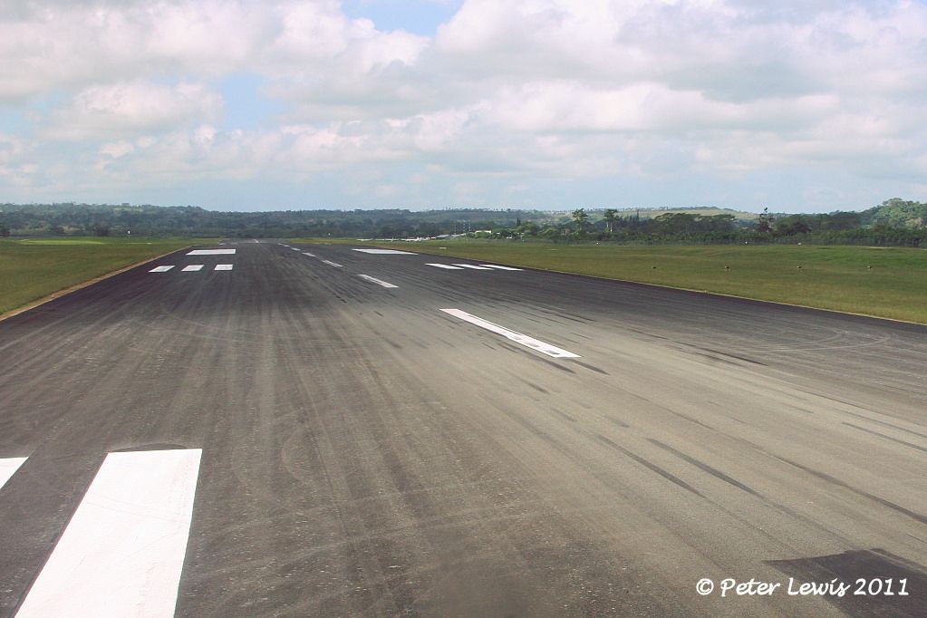 However, this field was initially built by the US Navy in 1942 to protect the local sea routes and to attack the Japanese positions in Guadalcanal. Building the Navy's Bases in World War II states: "The 3rd Naval Construction Detachment, made up of Companies C and D of the 1st Construction Battalion, 506 officers and men, sailed from the United States on April 12, 1942, and landed at Efate on May 4. The war at that time was a race between the Japanese and the Americans. Our forces had to get their planes into the air to stop the Japanese construction of an airfield on Guadalcanal, from which they would be able to attack the all-important Allied supply lines across the South Pacific. Therefore, the first and major job at Efate was the construction of an airfield. When the Seabees arrived they found that the Marines had already cleared and surfaced with coral about 2,000 feet of a 200-foot-wide landplane runway near Vila. The responsibility for construction was immediately assumed by the Seabees, who cleared, grubbed, and graded a 6,000-foot runway, 350 feet wide. Finger coral was used as surfacing material. Available construction equipment was very meager. Even after the Seabees pooled resources with the Army and Marines, the total equipment included one crane, ten trucks, two motor patrol graders, one pull-type grader, seven bulldozers of various sizes, and one scarifier. To keep the equipment from breaking down was a continuous job. Seabees, soldiers, Marines, and natives worked steadily under difficult conditions, and on May 8, the first planes landed on the field." Wartime map showing the field and associated approaches 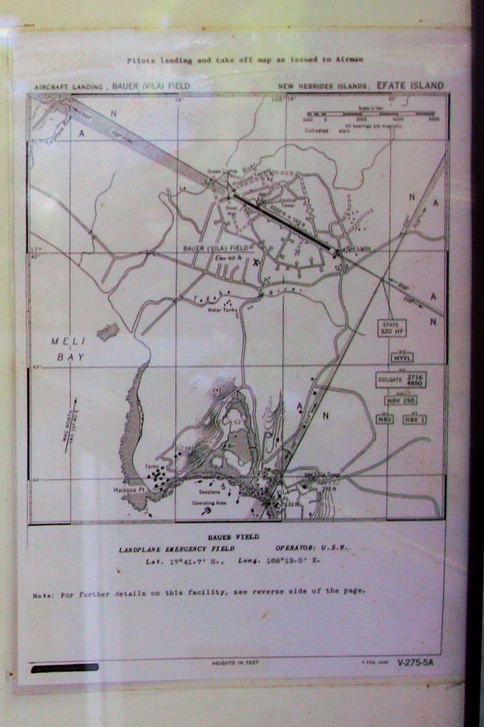 The field was named after Lt. Col. Harold Bauer, C.O. of VMF-212, killed in action at Guadalcanal on November 14th 1942. Bauer was credited with 11 confirmed aircraft shoot downs and also was awarded the Congressional Medal of Honor. There are memorial displays in his honour in both the public area of the airport terminal 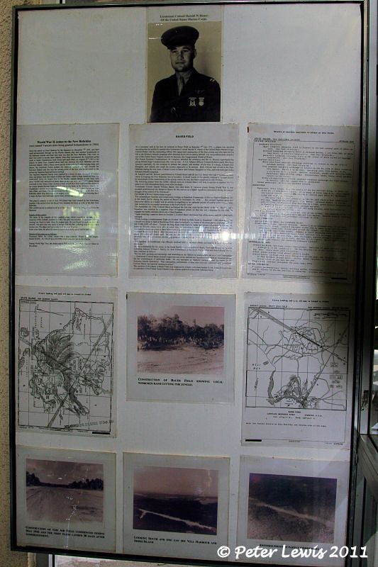 and in the overseas departure waiting area 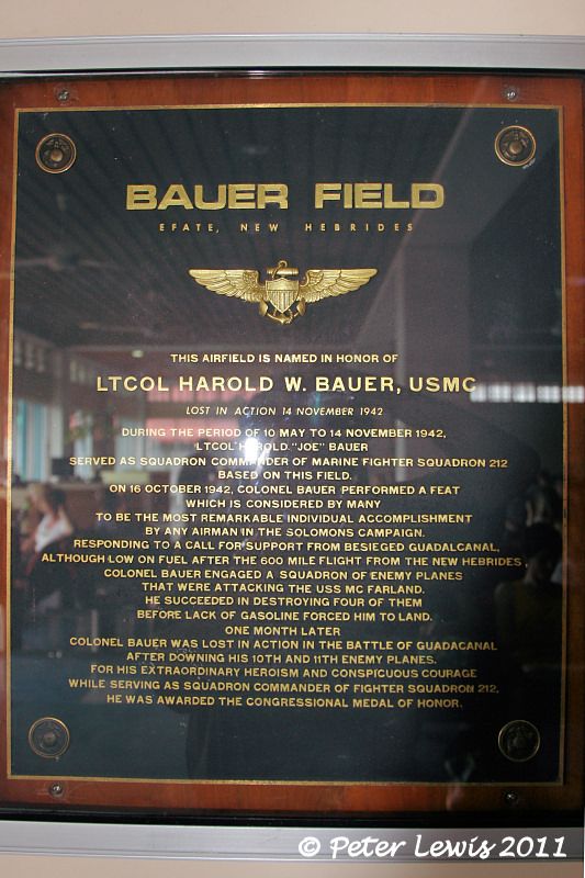 Also, in one corner of the terminal there is a glass case display containing a damaged prop/Wright R-1820 from a Douglas Dauntless, a bomb casing, and an information board recording the history of the airfield 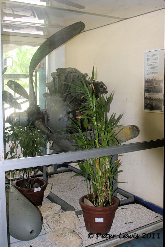 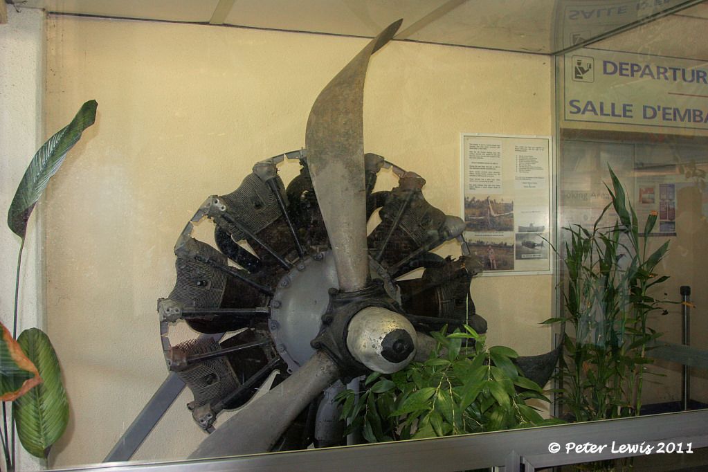 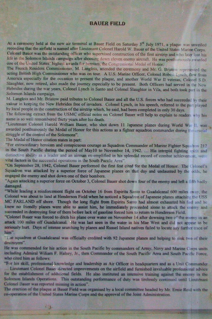 Bauer Field is the hub and maintenance centre for Air Vanuatu, and the base for several local GA charter operators. Externally, the terminal buildings are pretty standard for a Pacific Island country 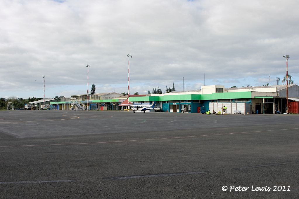 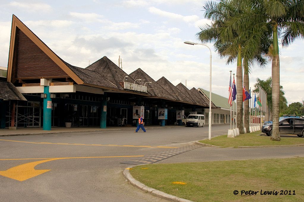 |
|
|
|
Post by Peter Lewis on Jul 24, 2011 9:12:12 GMT 12
A short distance from Bauer Field is Port Vila town and its associated harbour. 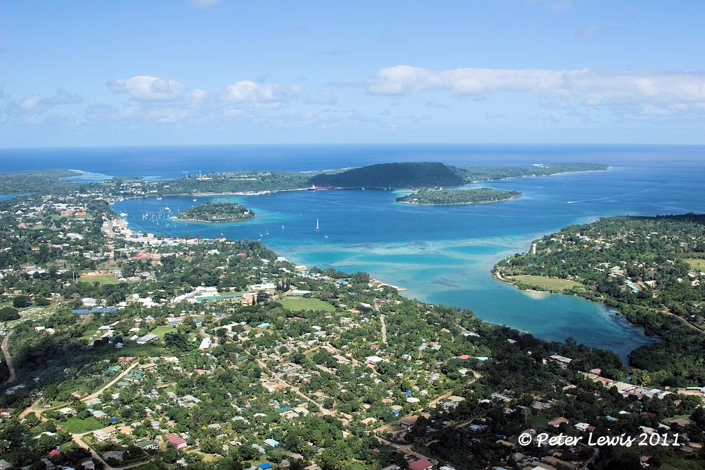 Its suitability as a seaplane base is obvious, and apparently the Australians had a small flying boat contingent here prior to the arrival of the Americans. This base was developed by the US Navy, and the location can be verified by reference to the Bauer Field map shown above. Port Vila seaplane base during the war 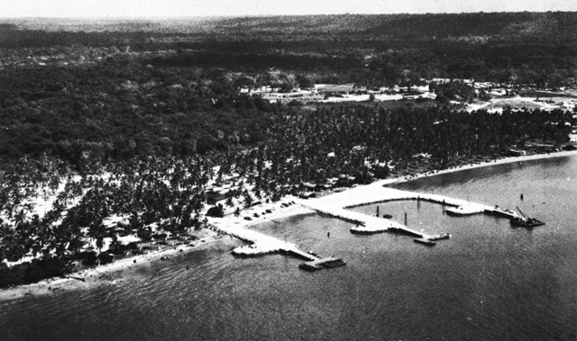 The location is at the northern end of the harbour, about where the Port Vila yacht club is now located 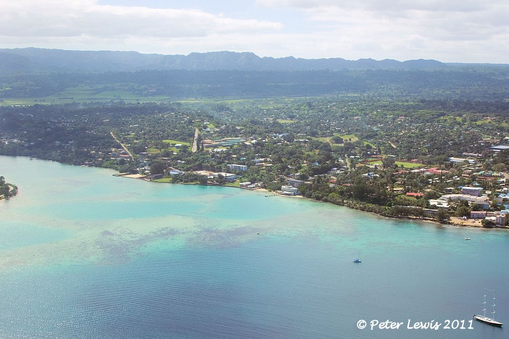 In the centre of the harbour lies Irirki Island, now a resort. The curved building on the main shore is a casino, and a ferry shuttle runs from there to Iririki. 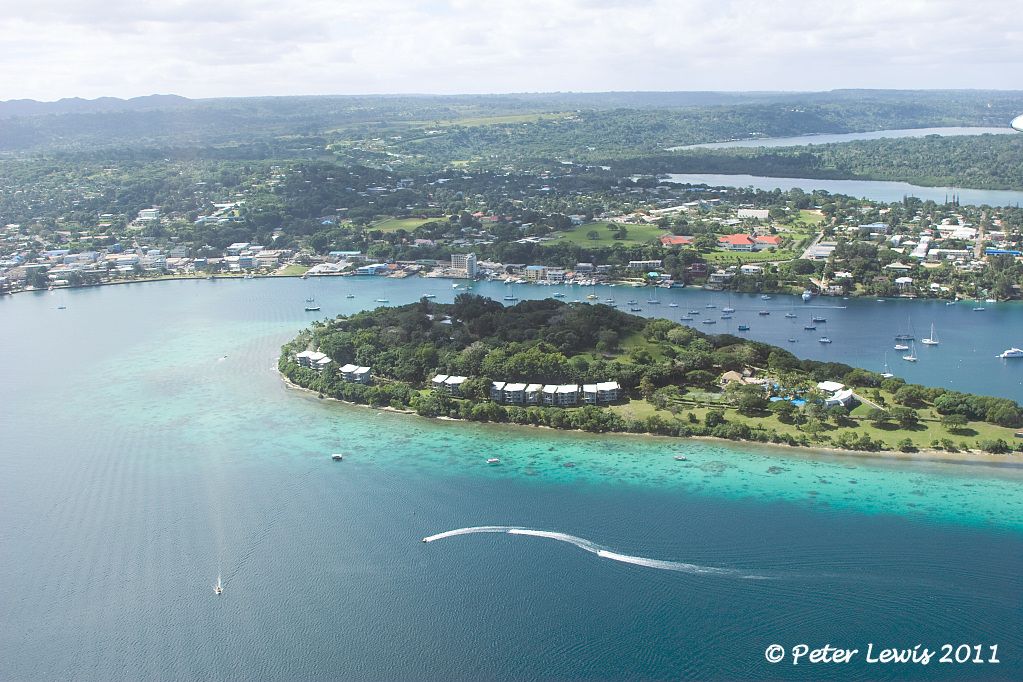 Post-war, Qantas serviced Port Vila with flying boats from the Australian mainland. One of the aircraft utilized by them was a Short S.25 Sandringham 'Tasman' class which had been built as a Sunderland III ML761 and then converted to passenger configuration by Shorts in 1946 for Tasman Empire Airways Ltd. as ZK-AMB 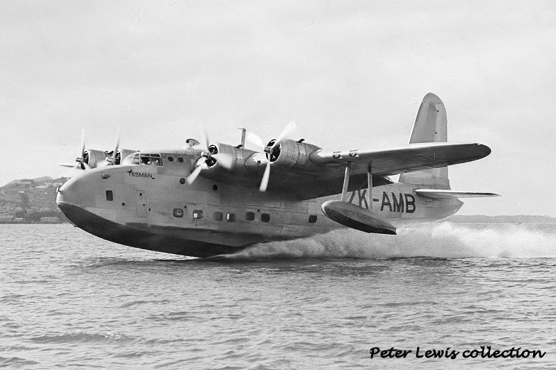 This aircraft went to Qantas Empire Airways (as it was known then) in 1950 as VH-EBW. On 10Jun1951 it was gathering speed on the take-off run in Vila harbour when it was forced to take evasive action to avoid a boat. In doing so, the aircraft struck coral and was badly holed. All on board were rescued but the Sandringham was too badly damaged to be repairable. 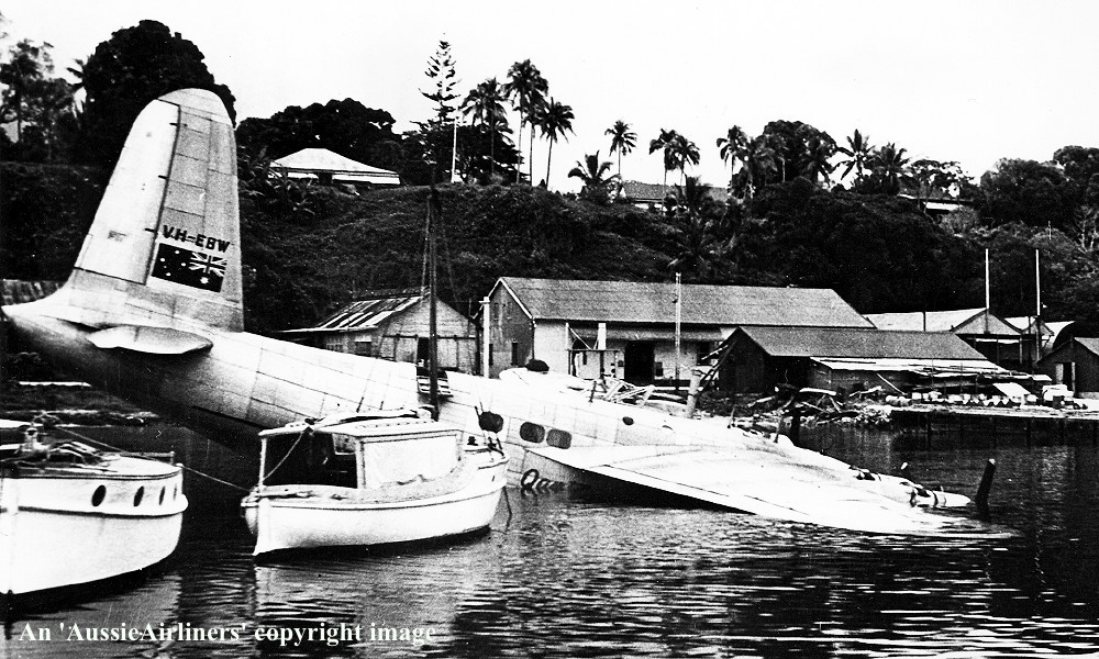 The stripped hulk was sunk in the harbour, and I am told that it resides about where the two ships are moored, at the southern end of the waterway. 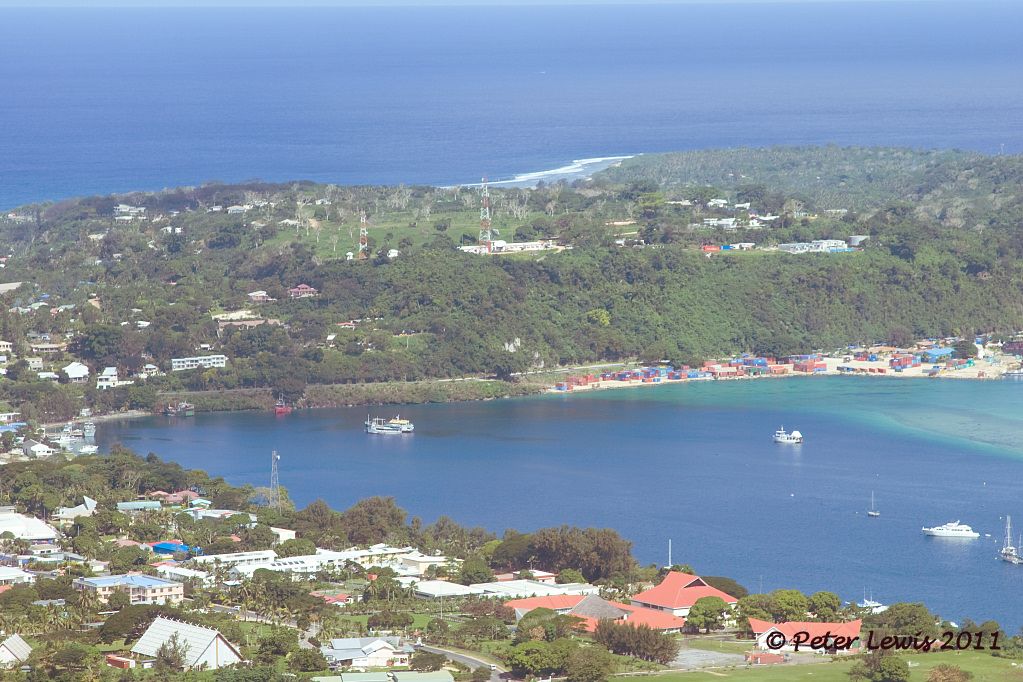 It is apparently diveable. Youtube video of a dive on the Sandringham here: Back in 1982, Piper PA30-160 Twin Comanche ZK-DOM departed New Zealand to become YJ-RV14 in Vanuatu. Ardmore, 1976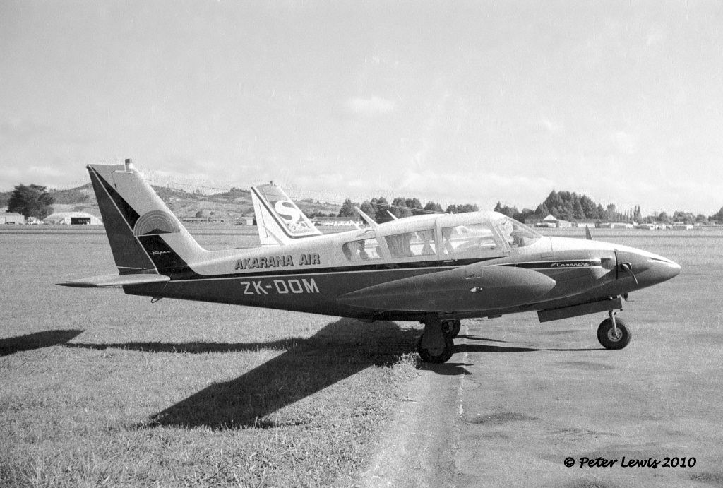 After some years of service, the aircraft was withdrawn at Vila and stripped. In 2009, the hulk was placed on the seabed at Port Vila as a diving attraction. You can see a video of the sinking here After a final lap around the town area, we head for the seaplane alighting area between Iririki Island and the wharves to end our flight 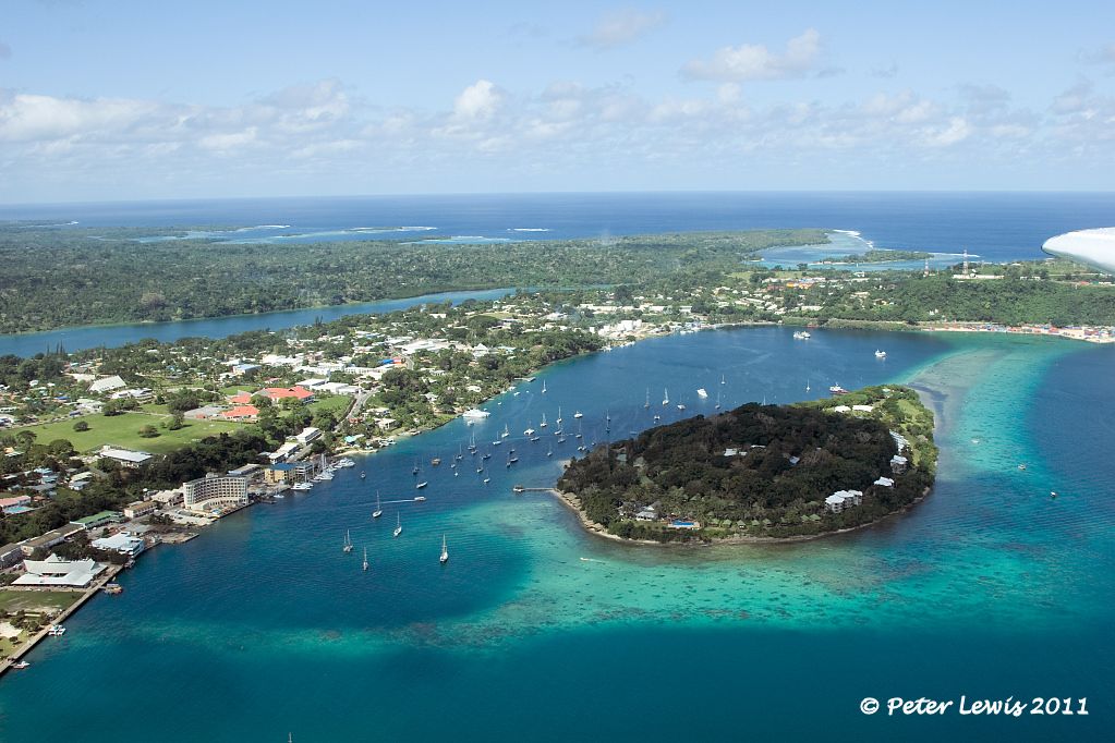 Water-taxiing across to the beach on Iririki Island we disembark. The end of our aviation history tour of Efate, Espirito Santo is next on the agenda. 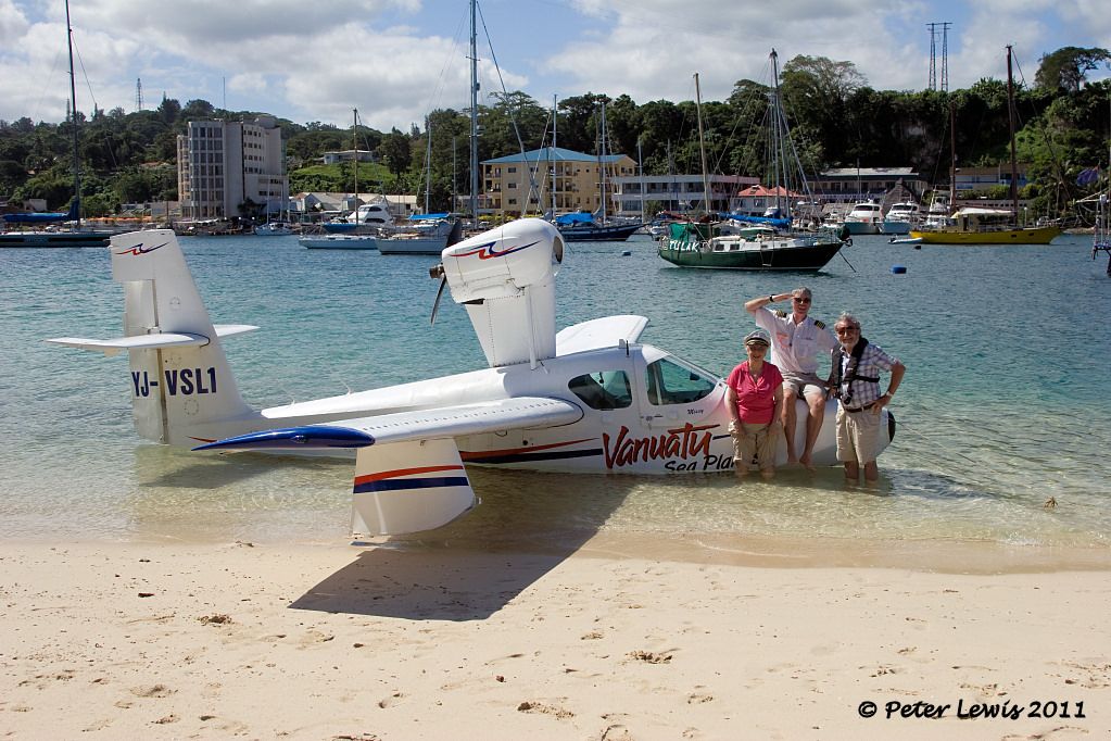 |
|
|
|
Post by Dave Homewood on Jul 24, 2011 12:37:54 GMT 12
Port Vila looks like a lovely place.
|
|
|
|
Post by Peter Lewis on Jul 26, 2011 20:53:14 GMT 12
Having wrapped up the island of Efate, we now move north to Espirito Santo, the largest island of Vanuatu. As the distance is too far to swim, we availed ourselves of Air Vanuatu's nice shiny ATR-72 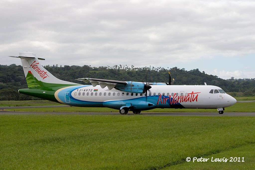 The main town of Sano is Luganville, located in the Segond Chanel in the south of the island, population about 13,000. Prior to WW2 this was just an outback trading post. No roads, you commuted between the few available stores and houses by boat. The harbour and surrounding countryside was identified in 1942 as a convenient place from which to attack the Japanese forces occupying the Solomon Islands. 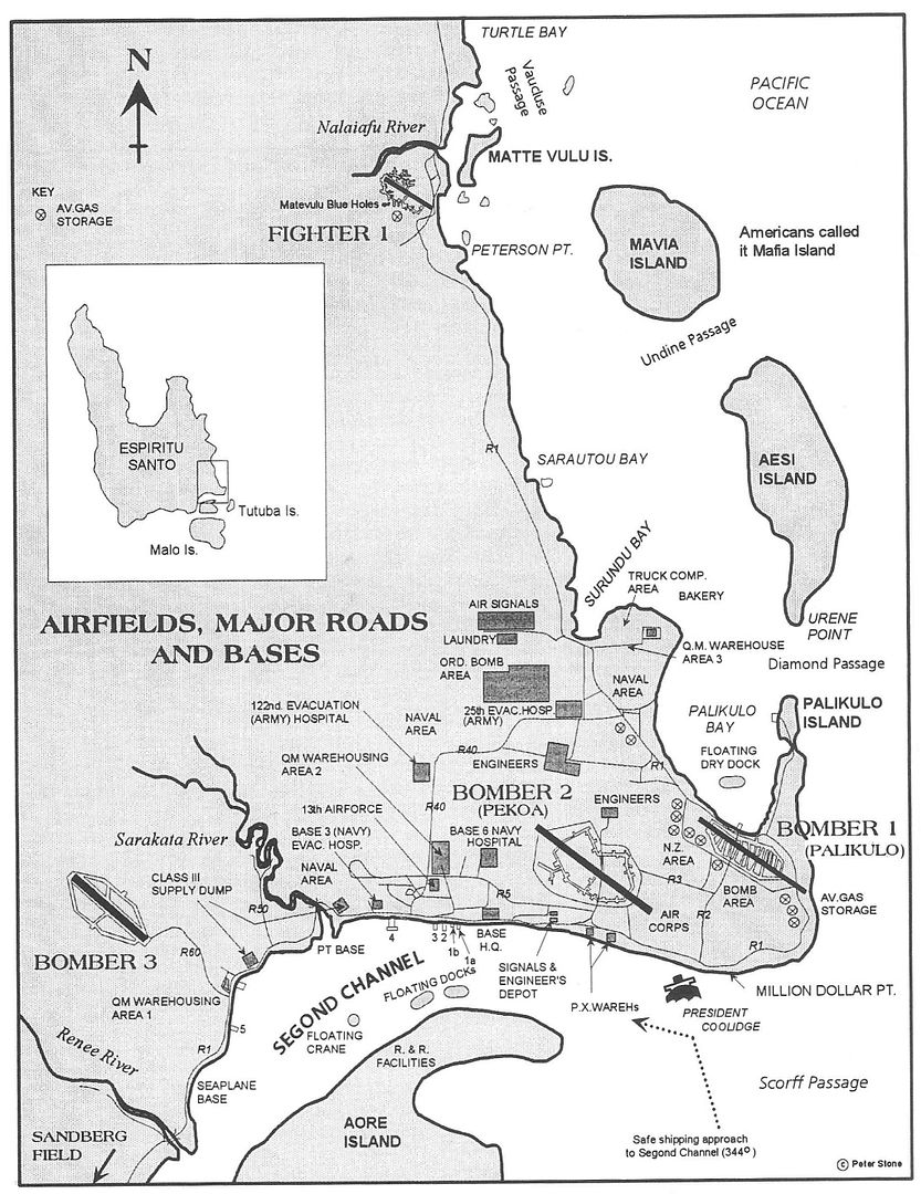 From Building the Navy's Bases in World war II: "When the Japanese moved into the Solomons and began construction of airfields on Guadalcanal, an Allied air base in an advance area became vital. The choice of Espiritu Santo, 630 miles southeast of Guadalcanal, in the New Hebrides, as a site for a major Army and Navy operating base, brought the U.S. bombers 400 miles closer to the Japanese positions and provided a staging area for the forthcoming Allied invasion of the Solomons. The base provided aircraft facilities capable of supporting heavy bombers, fighters, and two carrier groups; an accumulation of ammunition, provisions, stores, and equipment for offensive operations; repair and salvage facilities for all types of vessels. It became a vital link between Henderson Field on Guadalcanal and the airfields at Noumea and Efate. "Espiritu Santo is the northernmost and largest of the New Hebrides islands. It has an irregular outline, with numerous small islands near its shores. Heavily wooded and mountainous, particularly in the south and west where the highest peak rises to more than 6000 feet, Santo, as it is locally known, is about 75 miles long and 45 miles wide. Like that of Efate, the government is under joint British and French control. "A small reconnaissance party of three men left Efate on June 28, 1942, to find an airfield site closer than Efate to Henderson Field. Espiritu Santo was chosen, and on July 8, a small group of Seabees of the Efate detachment arrived at Santo with a Marine anti-aircraft battery and a company of colored infantrymen to begin work". "At Espiritu existed a fair example of South Pacific logistics. On 18 August Colonel Saunders described its unloading facilities as "one barge, a sandy beach and a prayer." Heavy equipment was slung over the side of cargo vessels into a lighter. Ashore there were no cranes and the small, finger piers made of coconut logs salted down with coral washed out and disappeared after 2 or 3 weeks' use. Since the supply officer seldom was informed of arrival dates, boxes and crates accumulated in the coconut groves. There was no question of living off the country; each item of food, clothing, and housing had to be brought in. The mud was there in abundance. Espiritu Santo a foot-thick covering of soft black dirt, a quagmire after the tropical rains." "At the same time, both the 7th and the 15th were engaged in providing other necessary facilities for the base as a whole. The 7th erected 60 quonset huts to be used as galleys, wards, operating rooms, dispensaries, and the like for CUB One Hospital, and 40 quonset huts and warehouses for Base Hospital Three. Another hospital of 100 beds, including quarters, wards mess hall, operating building, and other structures, was established by the 15th for Acorn 2 Hospital. In cooperation with the 822nd and the 350th Army Engineers, the 15th built quarters, wards, laboratories, and messing facilities for the 25th evacuation Hospital. They also provided surgery and storage buildings and handled electrical and plumbing work. These medical facilities proved to be extremely important for the Guadalcanal campaign in the latter part of 1942". Quonset huts under construction "The 7th built ten camps, varying in capacity from 100 to 1,000 men, with all facilities, roads, and drainage. The 15th provided seven additional camps for various base activities. An outstanding project was the enlisted men's galley and mess hall, equipped to feed 1,000 men in one hour, which the 15th constructed. All decks were of concrete, and complete drainage and plumbing systems were laid out and built with 6-inch quick-coupling pipe and parts of empty oil drums". An average of 40,000 United States military personnel were stationed in Luganville at any one time and it is estimated the between 400,000 and 500,000 military personnel took R & R on the island, operating 3 bomber airfields, a huge wharf and a nearby drydock. This era in Luganville's history is evident in the military-constructed Quonset huts still scattered around town. 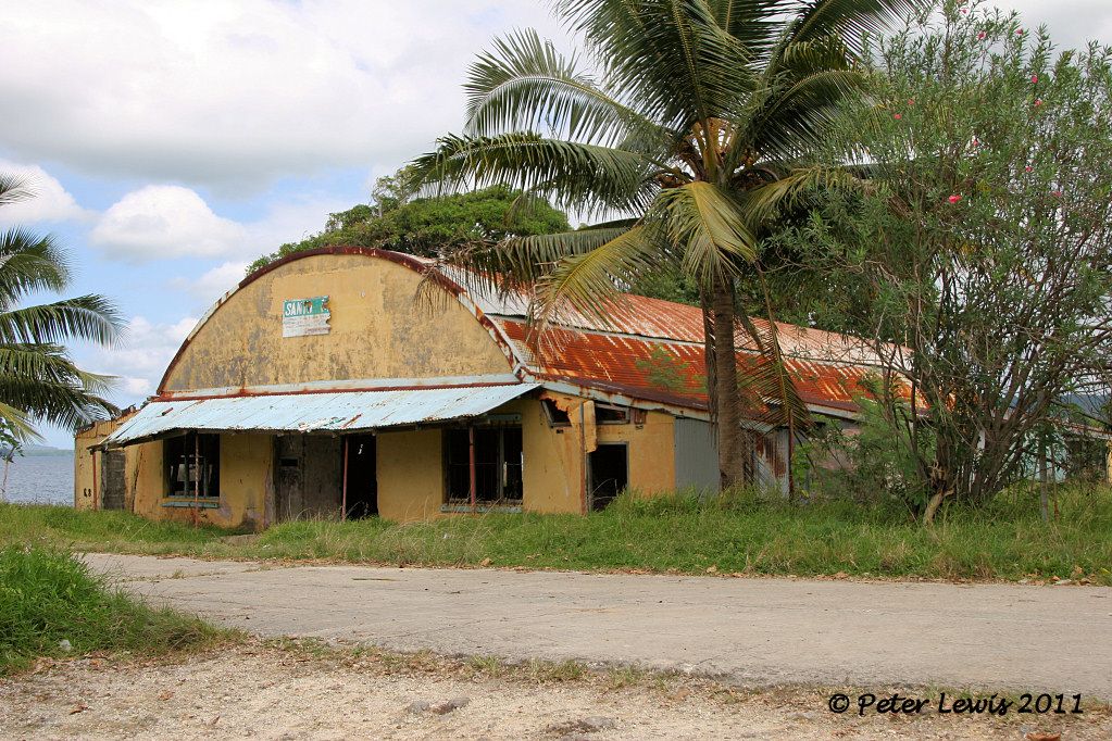 Wartime map of the Segond Channel area (thanks Dave) 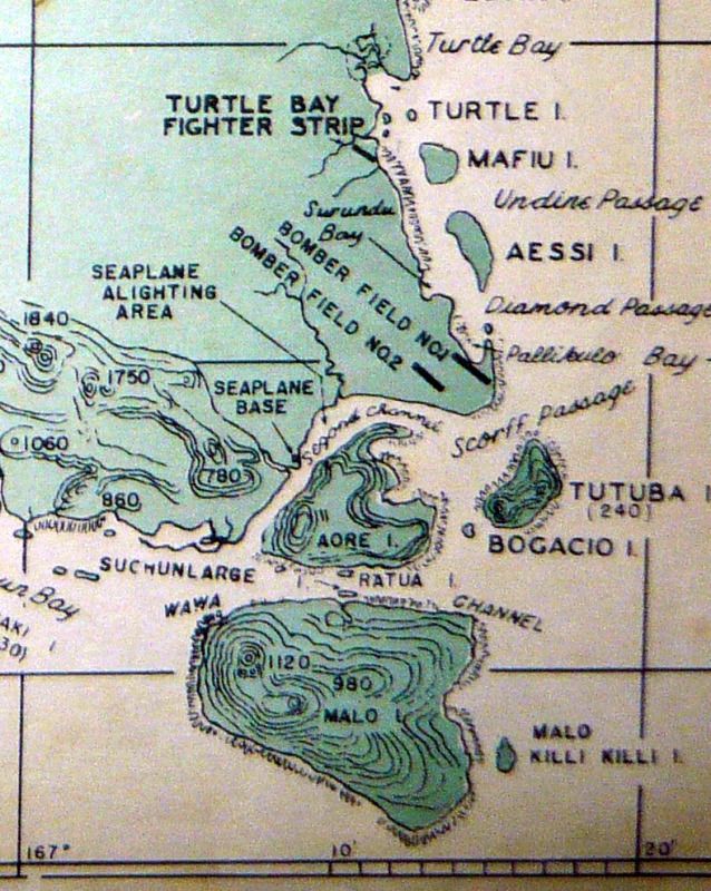 "At Aore Island, the battalion erected quonset huts for housing, 30 magazines for mine storage, and other installations for the mine-assembly, target-repair, and mine-recovery plants. On the same island, they constructed fifty 10,000-barrel bolted tanks for fuel storage, 25,000 feet of 12-inch spiral pipe, and 50 pump units. Other oil facilities provided at Santo included seventeen 1,000-barrel tanks for motor gas storage, two 10,000-barrel tanks for diesel storage, and twenty-three 1,000-barrel tanks for aviation gasoline. " Aore Island is now partly a tourist resort, accessible from the mainland by passenger ferry 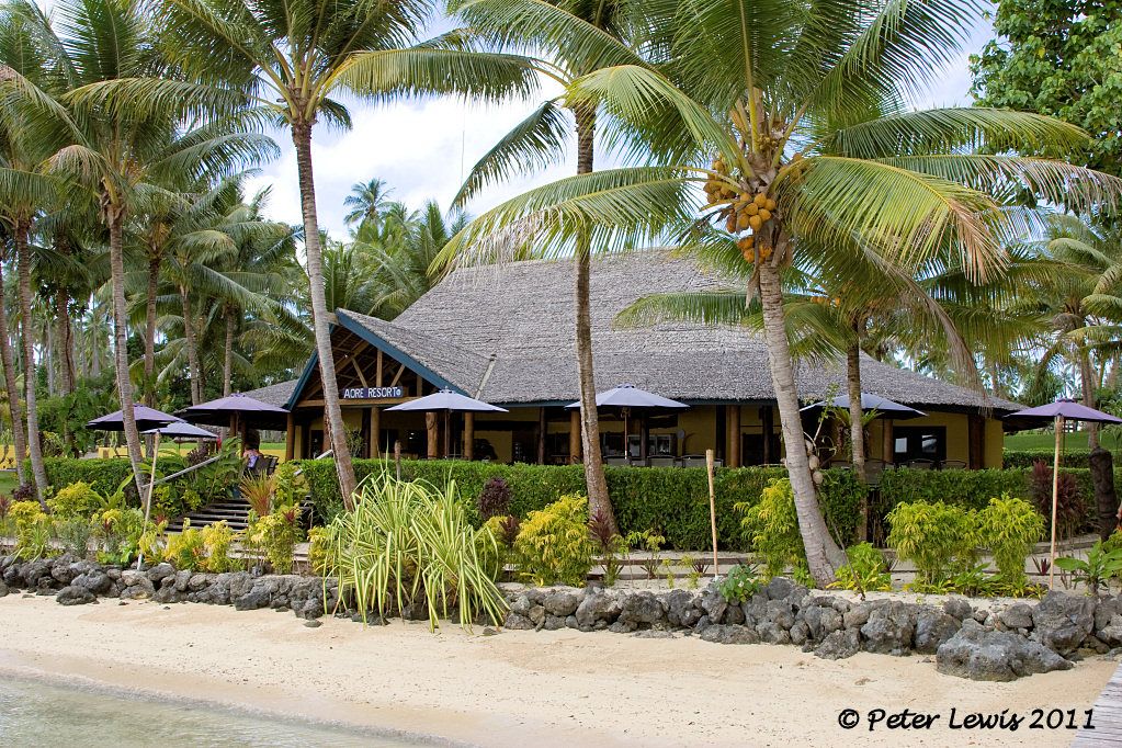 However, its wartime role is still evident with underground bunkers visible 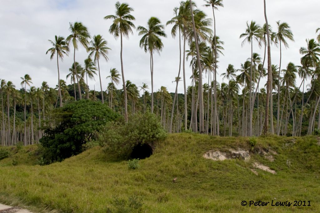 and some wartime material on display 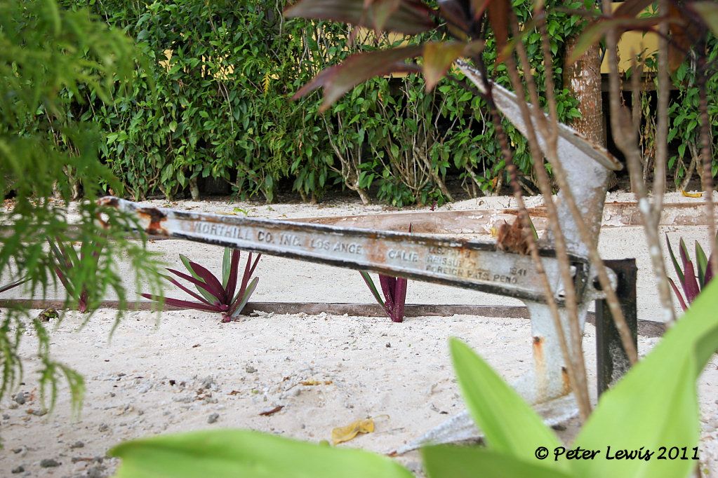 You can see even more debris at the infamous 'Million Dollar Point'. Surplus US equipment was dumped into the sea here after the local government refused to buy it from the departing US forces at a knock-down price, apparently in the belief that they could simply acquire it for nothing after the American departure 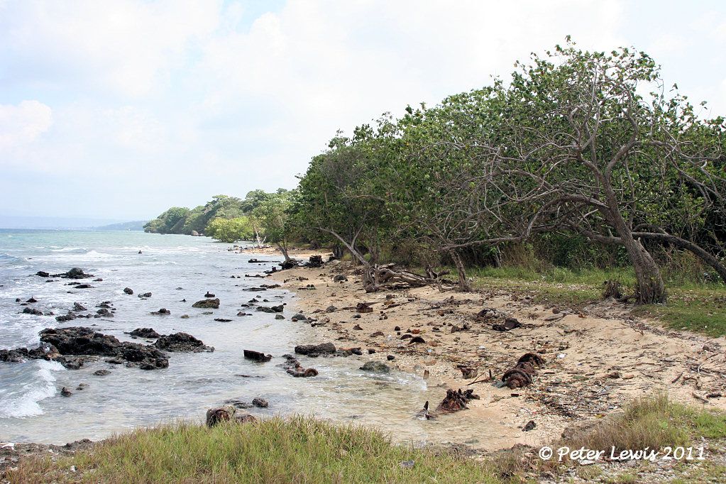 So Luganville and the Segond Channel in 1942-43 would have been a place of extreme contrasts. Thousands of military personnel around the waterfront were working day and night 7 days a week unloading a continuous stream of Liberty ships bringing in 1940s technology in the form of hospitals, military supplies, machinery, communications equipment, munitions and the very latest in aircraft and warships while the few remaining French and Indo-Chinese traders were corralled at the far end of town. The local people camped back in the bush in their traditional rural villages while in the misty valleys over the next line of hills some of the most primitive people in the world lived out lives unchanged for the last thousand years. |
|
|
|
Post by agalbraith on Jul 26, 2011 21:55:01 GMT 12
Fantastic thread, bringing back some great memories for me and Belynda! A lot of it still looks the same as it did 10 years ago.
Cheers
Anthony
|
|
|
|
Post by agalbraith on Jul 26, 2011 21:58:12 GMT 12
Did you manage to get up to Champange beach?
Cheers
Anthony
|
|
|
|
Post by Dave Homewood on Jul 26, 2011 23:16:29 GMT 12
I'm looking forward to shots of Pallikulo, the RNZAF's bomber base there. I hope you made it there.
|
|


