|
|
Post by pjw4118 on Nov 12, 2014 18:17:34 GMT 12
The location and pictures of military bases always seems of interest, so I have has a look at the current Navy bases There’s Devonport pictured in 1946 by Whites, quite a flotilla in port 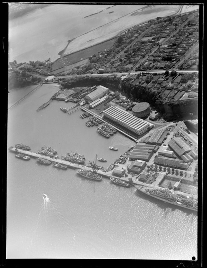 And the major redevelopment at Whangaparoa, which I can’t find a name for 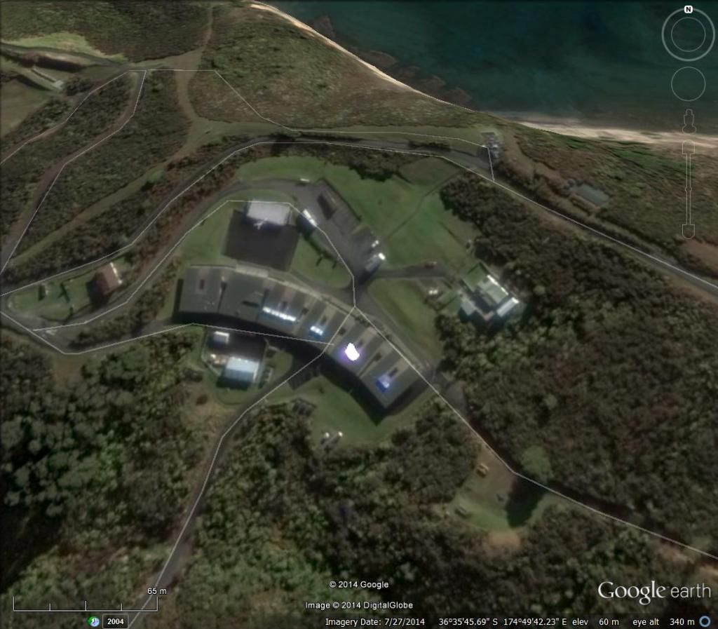 The joint services ammo dump at Kiwi Point 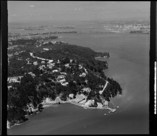 The less secret HMNS Irirangi at Waiouru According to the release it was formed in 1942 and handled hundreds of thousands of cables for the British Pacific Fleet It must have handled other things as it was named as a radio intercept station before handing over to the GCSB in 1993 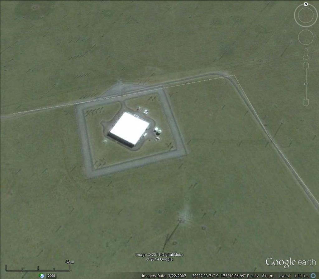 Little is said of the outstation on Great Barrier Island. A local tells me is equipped at times with very powerful range finders and radar, and its underwater acoustic array can detect loose cargo rolling around aboard ships 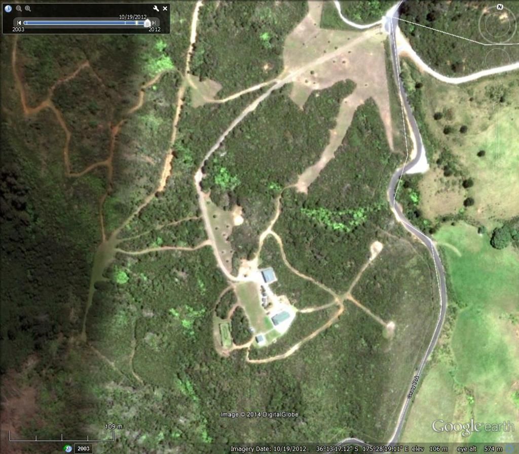 It would be nice to know more |
|
|
|
Post by phil on Nov 12, 2014 18:33:14 GMT 12
Whangaparoa is TLC or Tamaki Leadership Centre. This is where the Navy carry out a lot of their training for their BCTs, Officers etc
It is also the location of their small arms ranges, also used by the RNZAF.
|
|
|
|
Post by suthg on Nov 12, 2014 20:12:18 GMT 12
My Aunty Hylda Sutherland Nee Callendar was a WRNZ working at HMNS Irirangi at Waiouru starting in 1943. One of their tasks was intercepting submarine LW signals and determining the direction of the ship by triangulating the signal strengths from two aerial systems at 90deg to each other. She was acknowledged as having intercepted one such message that gave the NZDF an idea of location of a Japanese submarine in our neighbourhood.
|
|
|
|
Post by Dave Homewood on Nov 13, 2014 7:44:03 GMT 12
Whangaparoa is TLC or Tamaki Leadership Centre. HMNZS Tamaki used to be on Motuihe Island (1941-2000). Originally it was for training new recruits and most of our Fleet Air Arm pilots spent 30 days there before heading to the UK. Is this Whangaparoa centre named after that base? |
|
|
|
Post by flyjoe180 on Nov 13, 2014 10:36:12 GMT 12
I did not realise Whangaparoa had changed so much.
|
|
|
|
Post by phil82 on Nov 13, 2014 14:35:48 GMT 12
I believe Shelly Bay in Wellington was originally a Naval Base.
|
|
|
|
Post by flyjoe180 on Nov 14, 2014 10:15:34 GMT 12
|
|
|
|
Post by phil82 on Nov 14, 2014 10:23:17 GMT 12
Just a note re:Irirangi: during the Falklands war, the RN used Irirangi as a relay for transmissions to the UK.
|
|
|
|
Post by pjw4118 on Nov 14, 2014 12:06:53 GMT 12
They must have had good equipment Phil as I was just reading that Awarua radio in Southland would pick up U Boat transmissions in the South Atlantic and pass them on to UK. And Awanui radio near Kaitaia handled South Pacific traffic for the US Navy and pass it on to Pearl Harbour. So there was plenty of listening going on back then.
|
|
|
|
Post by Barnsey on Nov 15, 2014 0:28:20 GMT 12
The 1978 Armed Forces Establishments Road Traffic Bylaws lists the following Navy locations: Navy Establishment Location Naval Supply Depot Devonport. Defence Scientific Establishment Devonport. HMNZ Dockyard Devonport. HMNZS Philomel Devonport. HMNZS Tamaki Devonport. HMNZS Tamaki Boatyard Devonport. Naval Radio Station and Training Area, North Head Devonport. RNZN Married Quarters Area Wakakura Crescent, Devonport. HMNZS Ngapona Ponsonby. RNZN Armament Depot Kauri Point, Birkenhead. RNZN Armament Depot Whangaparaoa. HMNZS Irirangi Waiouru. RNZN Stores Depot Islington Bay, Rangitoto. www.legislation.govt.nz/regulation/public/1978/0149/latest/DLM63175.html |
|
|
|
Post by Dave Homewood on Nov 15, 2014 9:59:45 GMT 12
The Married Quarters at Devonport were gifted by Labour to the local tribe.
|
|
|
|
Post by pjw4118 on Nov 24, 2014 15:21:48 GMT 12
Interesting comments. Just to fill in the gaps with Whites Aviation Photos North Head 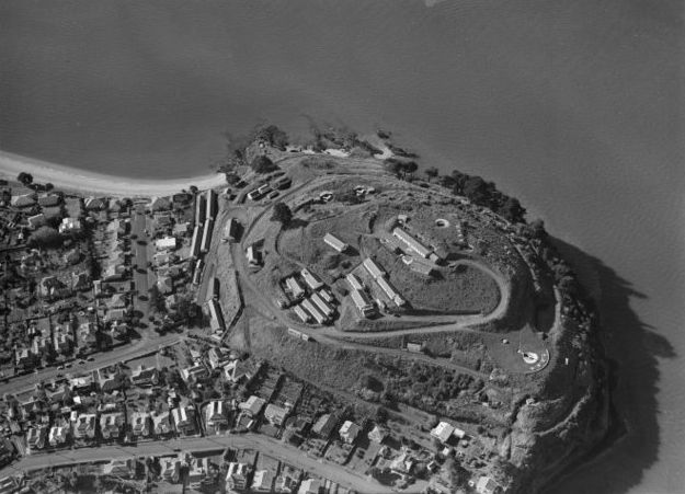 Motuhie in 1953 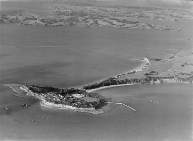 Rangitoto in 1946 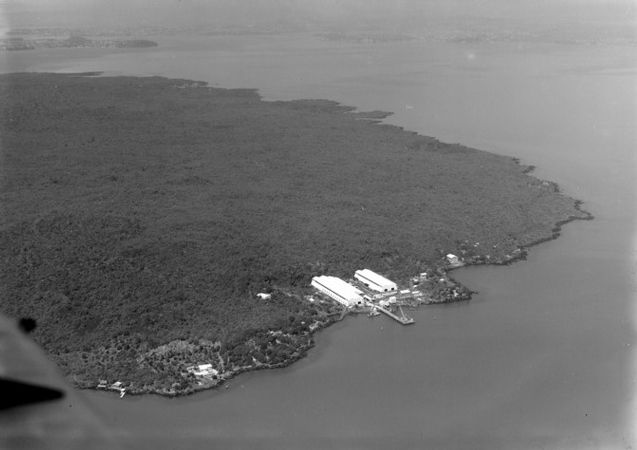 Kauri Point 1947 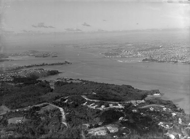 |
|
|
|
Post by Dave Homewood on Nov 24, 2014 18:21:06 GMT 12
I am pretty sure there was a large Navy base, along with the Army's anti-aircraft batteries, on Motutapu Island.
|
|
|
|
Post by raymond on Nov 24, 2014 19:11:21 GMT 12
I am pretty sure there was a large Navy base, along with the Army's anti-aircraft batteries, on Motutapu Island. On Motutapu there is Admin Bay which has a few of the old Barracks now used for Camps (Schools etc) and at Home Bay you can see the remnants of some stores buildings. Then further out there is the gun batteries and control rooms. At the top of Rangi there once was a radar station I recall. If you take a walk from Rangi Wharf to Motutapu along the coast you will come across what I think is the old seaplane base, big concrete apron ramp etc. |
|
|
|
Post by Dave Homewood on Nov 24, 2014 19:41:23 GMT 12
The Army had a load of anti-aircraft guns and barracks with men and WAACs at one end of Motutapu, and at the other end was the Navy, who I think had six inch guns for firing at ships. There were around (or at least) 300 people in each camp. I know a lovely old lady who served there for 3-4 months as a range finder for the AA guns. She said the Army and Navy never mixed much, and they all had to stay on the island till their tour was over, no popping across to Auckland to go shopping or anything like that.
The Navy of course had a huge network of electrically linked mines throughout the Hauraki Gulf/Auckland Harbour all connected and able to be detonated from special huts on each of the islands, and from central Auckland. if any ship tried to enter port without clearance they were to hit the switch and around 600 mines would blow. That would have been very impressive! In 1944 one of the sailors I have interviewed was given the job of leading the team to dismantle the minefield. It took months.
|
|
|
|
Post by Bruce on Nov 24, 2014 21:25:18 GMT 12
I am pretty sure there was a large Navy base, along with the Army's anti-aircraft batteries, on Motutapu Island. On Motutapu there is Admin Bay which has a few of the old Barracks now used for Camps (Schools etc) and at Home Bay you can see the remnants of some stores buildings. Then further out there is the gun batteries and control rooms. At the top of Rangi there once was a radar station I recall. If you take a walk from Rangi Wharf to Motutapu along the coast you will come across what I think is the old seaplane base, big concrete apron ramp etc. That will be the former Navy minesweeping depot at Islington Bay. |
|
|
|
Post by TS on Nov 24, 2014 21:40:15 GMT 12
Is that photo of Rangitoto 1946 of Islington Bay?  Sorry but it just does not look correct because at the top left corner that Island looks like Motuhie and to the right looks like Music Pt. Or that is the inlet to Islington Bay top left and Motuhie to the right. So what are those large buildings on Rangi??? I would but them on the western side so that would have them facing toward North Head... would that be correct?? |
|
|
|
Post by pjw4118 on Nov 25, 2014 12:27:54 GMT 12
Looking at the Rangitoto photo again , I think it is reversed. The big sheds were on the city side of the bay and the foundations can still be seen on Google Earth. Likewise the huts and gun pits on Motutapu show up clearly.
On the summit of Rangitoto there was a concrete roofed observation bunker , not sure about radar being there but there was one on the top of Mt Eden
|
|
bart
Leading Aircraftman

Posts: 2 
|
Post by bart on Dec 27, 2014 17:55:55 GMT 12
The location and pictures of military bases always seems of interest, so I have has a look at the current Navy bases There’s Devonport pictured in 1946 by Whites, quite a flotilla in port  And the major redevelopment at Whangaparoa, which I can’t find a name for  The joint services ammo dump at Kiwi Point  The less secret HMNS Irirangi at Waiouru According to the release it was formed in 1942 and handled hundreds of thousands of cables for the British Pacific Fleet It must have handled other things as it was named as a radio intercept station before handing over to the GCSB in 1993  Little is said of the outstation on Great Barrier Island. A local tells me is equipped at times with very powerful range finders and radar, and its underwater acoustic array can detect loose cargo rolling around aboard ships  It would be nice to know more |
|
bart
Leading Aircraftman

Posts: 2 
|
Post by bart on Dec 27, 2014 18:09:43 GMT 12
There is little at the Rnzn Field Station to help conspiracy theories A!
The photo on this site is the "old" station set up by Defence Scientific Establishment.
The present station is a collection of buildings at the highest point overlooking Lion Rock.
The principle sensors are the sonar hydrophones employed to measure ship noise as the ships pass over the central of 3 hydrophones
The signature of every ship is unique and can be used for identification or detecting undetected machinery noise.
The range is a designated no fishing/anchoring to protect the hydrophones.
The hydrophone signals are made available to universalists for earthquake detection and whale watch.
|
|