|
|
Post by Dave Homewood on Sept 11, 2018 23:31:15 GMT 12
Forum member OJ has asked me to post these satellite images and the link to this facility as he'd like to find out what the place is, or does. he wonders if any pilots here have flown over it or if anyone has ideas of what it is. It's south of Raglan. 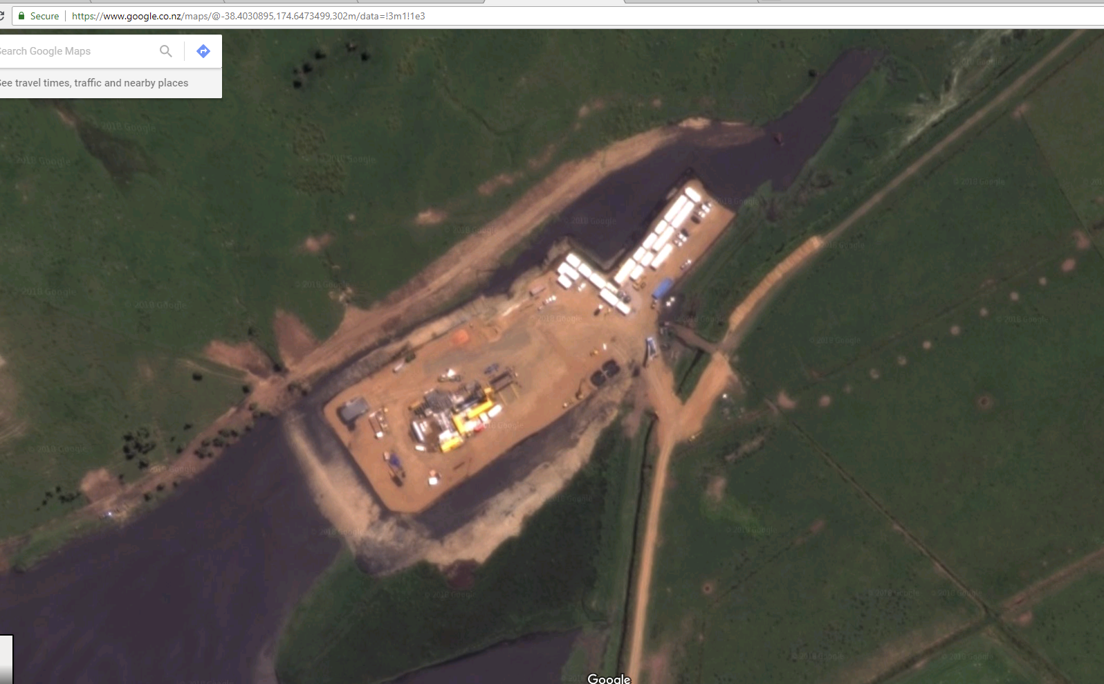 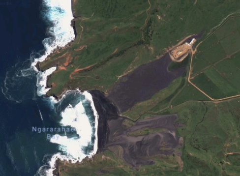 goo.gl/maps/gbLYssx41sR2 goo.gl/maps/gbLYssx41sR2 |
|
|
|
Post by isc on Sept 12, 2018 0:49:56 GMT 12
? Something to do with Iron Sand mining. A big P lab.
Scanned The map south a bit to Te Marama Rd, and found an airstrip. isc
|
|
|
|
Post by delticman on Sept 12, 2018 8:48:44 GMT 12
Forum member OJ has asked me to post these satellite images and the link to this facility as he'd like to find out what the place is, or does. he wonders if any pilots here have flown over it or if anyone has ideas of what it is. it's north of Raglan. goo.gl/maps/gbLYssx41sR2Is that not Tahoroa, well south of Raglan where the iron sand is ex ported to Japan. If it is, there is a sealed airstrip nearby |
|
|
|
Post by markrogers on Sept 12, 2018 9:29:31 GMT 12
Yes, my initial thought on looking at the satellite images was Taharoa where the ironsand is.
|
|
|
|
Post by Dave Homewood on Sept 12, 2018 10:01:17 GMT 12
On Google Maps - the link is in my original post -it's quite south of Taharoa, and south of Marokopa.
|
|
|
|
Post by Dave Homewood on Sept 12, 2018 10:03:24 GMT 12
My thoughts were also iron sand mining but OJ reckons it isn't. I have no idea about it, this post was made for OJ, he needs to come here and comment.
|
|
|
|
Post by oj on Sept 12, 2018 10:24:06 GMT 12
Guys, it is definitely not Taharoa. I have flown in and out of Taharoa airstrip (as a passenger).
This facility is further south. you have to zoom in and out to get your bearings.
Note that there is the name of the bay, Ngararahae Bay as a reference.
We need some feedback from a microlight pilot or ag pilot.
|
|
|
|
Post by pepe on Sept 12, 2018 12:57:19 GMT 12
It is (or was) an oil exploration/drilling facility located on Nukuhakari Station, Waikawau.
I thought the operation had now scaled back and wonder how old the satellite image is?
From memory, I think the drilling was horizontal (out under the seabed) which is a bit of a sore subject these days...
|
|
|
|
Post by oj on Sept 12, 2018 13:35:45 GMT 12
Thank you pepe, I can sleep better now.
I thought it was a clandestine export facility for processing stolen quad-bikes that get cleaned, repainted and sold to third-world countries around the pacific. Apparently that is what happens to many of them.
|
|
|
|
Post by FlyingKiwi on Sept 12, 2018 20:09:58 GMT 12
Adding to the above correct comments that this doesn't show Taharoa, the Taharoa airstrip is also now closed and has been for several years, although the strip is still sort-of evident.
|
|
|
|
Post by isc on Sept 12, 2018 23:42:24 GMT 12
A bit of a look on Google, a report on Stuff dated Feb 4 2012 indicates that it is/was one of many sites, a number of them old sites, but this time the system of fracking was used. This one is at the north of the field, it goes south to Manutahi, and west to the Maui field. So they were doing more than just going sideways. isc
|
|
|
|
Post by oj on Jan 11, 2023 19:23:49 GMT 12
I was discussing this site with a work colleague today, and using the Google Earth timeline feature we see that the site was disestablished after 2018 and current imaging shows no trace of the exercise.
So a lot of money was spent over a couple of years or so but I have no idea what the outcome was or where the equipment went.
|
|
|
|
Post by Dave Homewood on Jan 11, 2023 20:35:56 GMT 12
They must have found out we were onto them!
|
|