|
|
Post by nzav8a on Dec 18, 2008 22:07:54 GMT 12
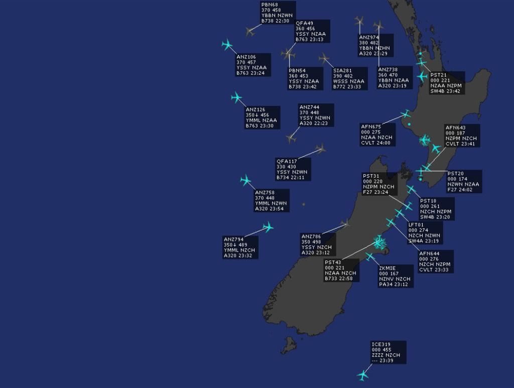
Traffic around NZ 11pm tonight  |
|
|
|
Post by Dave Homewood on Dec 18, 2008 22:47:11 GMT 12
Where the heck has that bottom one been? Is that a military aircraft returning from the ice?
|
|
|
|
Post by nzav8a on Dec 18, 2008 22:55:44 GMT 12
It is the Australian Government Airbus A319 coming back from the Ice
|
|
|
|
Post by timmo on Dec 19, 2008 8:29:05 GMT 12
Oh on that note- Ive put together a map of all the airspace boundaries for the Flightsim guys (i.e. not to be used for real world flying blah blah blah) based off the VNCs (although I havent updated the boundaries to reflect any changes in the latest map updates which came into effect late Nov since I didnt buy the full set of maps) The map can be found here: www.nzff.org/maps/It is based on the Google Maps API so work it the same as that: Panning, roll mouse wheel to zoom etc. Use the tick boxes to turn on the CTA and CTZ boundaries, as well as areas of Scenery for Flightsim. Double clicking on the polygon/point will bring up information such as Frequency, alts, tower or link to donwload the scenery respectively. The 3D view is something I haven't quite got working yet.....and it is not possible to select in the Z plane (i.e. youll always get the details of the highest airspace) not enough hours in the day! |
|
|
|
Post by FlyNavy on Dec 19, 2008 13:27:32 GMT 12
timmo, nice one - wannado that for Oz? ;D Good work - you will figure out the Z car thingo.
|
|


