|
|
Post by nuuumannn on Dec 15, 2011 0:16:39 GMT 12
Before Nelson disappears underwater this evening, I thought I might post some images I have taken over a period of time of some aviation related monuments and odds and ends around the town. most of these I have come across purely by accident whilst out and about, but all tell their own unique story. The following is not exhaustive of every aspect of aviation in the region, just what I have found to date. All of the images were taken by me except where indicated. Firstly, sites for landing aeroplanes: This simple concrete plinth marks the site where the first aeroplane landed in Nelson; on 11 November 1921 an Avro 504K landed on property belonging to the Marsden family. According to local legend, the man of the house demanded the airmen get their contraption off his lawn! Located across the road from the Stoke shopping centre on Main Road Stoke, today the land is used as a sports ground, although the Marsden family home, Isel House still exists a short way from the monument. 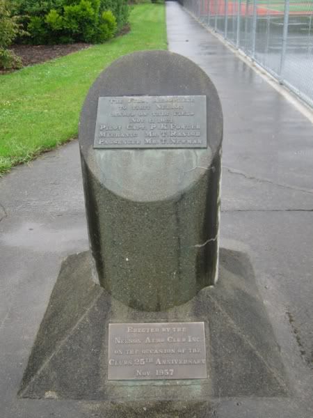 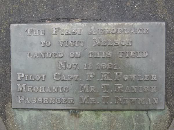 Established in 1933, Nelson's first aerodrome was at Saxton Field to the south of Stoke. The first image below looks in the direction of the row of hangars, which sat in line with the farther row of trees. Note the de Havilland badge at the top of the plaque, which acknowledges the use of the D.H.89a Dragon Rapide airliner by Cook Strait Airways from the site. After the airport was moved to Quarantine Road, a few of the hangars from the Stoke site were relocated there. Saxton Field now houses a large sports complex. 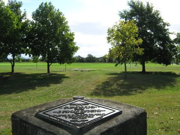 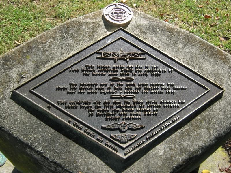 Below is a photograph of a photograph inside the Nelson Airport terminal showing the RNZAF base at Quarantine Road, which now serves as Nelson Airport. The two large hangars still exist, the top one, Hangar 1 is currently occupied by Helicopters New Zealand (HNZ) and Hangar 2, the lower one serves as Air Nelson's heavy maintenance hangar. The assault course built for RNZAF personnel at the far right of the picture under the peeling label is still in situ, although it is unused and over grown. 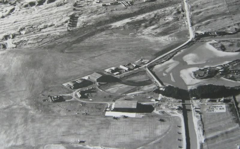 Nelson Airport from the air today. Dominating the buildings at the centre of the airport complex is the new Air Nelson maintenance hangar, with Hangar 2 adjoining it. The old Hangar 1 is visible with the red roof to the left of the Air Nelson complex. 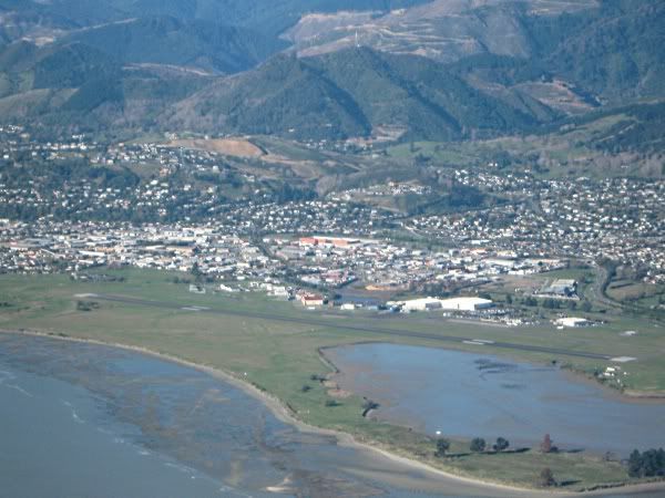 An aircraft forum members are familiar with; Messerschmitt Bf 109E-4 W/Nr 1653 suspended from the rafters of the RNZAF's Technical Training School, which occupied Hangar 2. 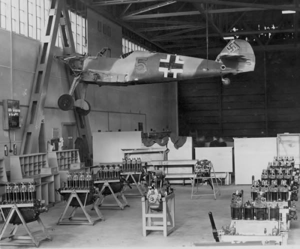 RNZAF Official The same hangar today from a slightly elevated position shows the A frame structure in front of which the Bf 109 was suspended. This hangar is now used for heavy maintenance of regional airliners by Air Nelson Base Maintenance. Note the ATR composite tool board at lower left. Because the building was constructed with its doors facing south, the hangar gets extremely cold in winter time, despite ceiling mounted heaters. Since ground level is so close to sea level, during high tide the hangar doors often get stuck in their rails because the rising waters shift the concrete pad the hangar sits on. 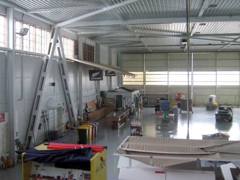 Aircraft hardware around the town: 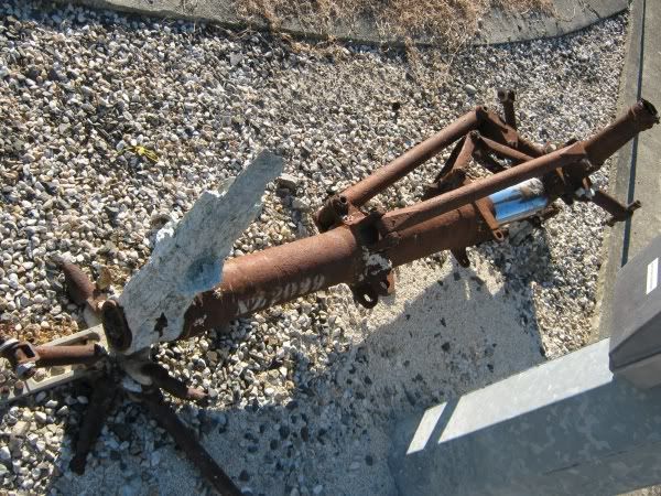 One of the main undercarriage legs of Lockheed Hudson NZ2029 sits airside beside the fire station next to Air Nelson's Hangar 2 at the airport. It snagged the net of a fishing boat in 1982 and was subsequently recovered, along with an engine and a propeller, which are held by a local diving club. ADF Serials records the fate of NZ2029: Hudson Mk.III NZ2029 S/n 3852, previously AE497 from British Purchasing Mission contracts. Shipped to New Zealand on Donerail, BOC Unit 1 Hobsonville on 20 October 1941 and assembled at No.1 Aircraft Depot Hobsonville. To No.2 GR Squadron Nelson. Crashed after hitting sea while low flying [during air gunnery exercise] over Tasman Bay 30 September 1942. The propellers struck the water before the aircraft climbed to about 200 feet and then crashed into the sea. Flying Officer Dean Horrocks, Sergeant Vincent Hill, Sergeant Jack Bryson, Sergeant Victor Chapple, Sergeant Gordon Stevens and AC1 John Davis killed. Warrant Officer J. Colway injured. Written off books at Nelson 16 October 1942. Although ADF Serials records the date in which NZ2029 struck the water as 30 September 1942, Errol Martyn in his excellent book For Your Tomorrow Volume One; Fates 1915 - 1942 records the incident occuring the day before, "...at about 1555 some 5 miles off Motueka". 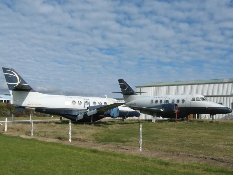 Of slightly more recent vintage, slowly corroding away at the northern end of the general aviation hangars are these two Jetstreams that formerly flew with failed domestic carrier Origin Pacific. 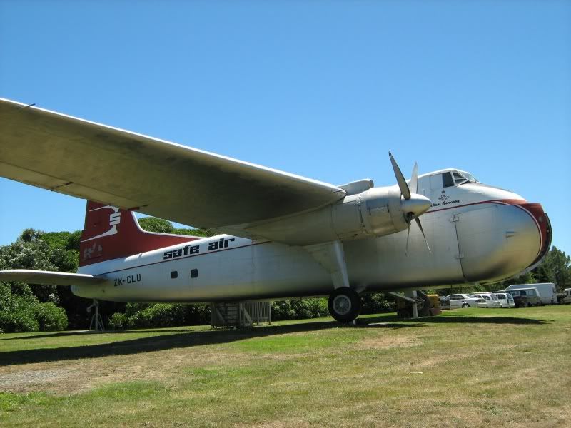 Also without a roof over its head is former Safe Air Bristol Freighter ZK-CLU Merchant Buccaneer. The aircraft landed at the Whakapuaka sand flats on the Nelson foreshore on 20 November 1986 and was dismantled and taken by road to its current location at the Founders Historic Park on Atawhai Drive. It serves as a walk through museum, with displays inside it detailing the use of the type by Safe Air. Two very different memorials to RNZAF personnel: The decorative stone commemmorating Nelson's most famous aviator son, Grp Capt Leonard Trent VC, DFC. This is located on Trent Road opposite the Air Nelson Technical complex on the way to the airport terminal. 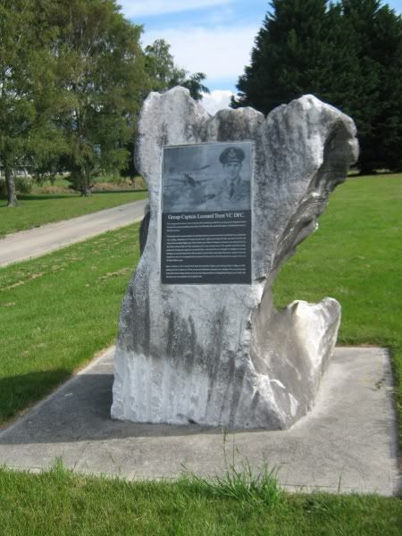 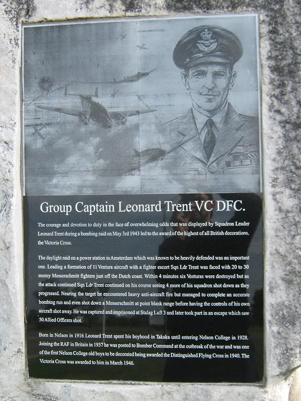 Finally for tonight, a virtually unknown soul lost on a routine training flight on 15 June 1940. Francis M. (Peter) McFarlane's headstone is at Stoke Cemetery on Seaview Road. This from For Your Tomorrow Volume One: Fates 1915 - 1942: Air to ground live firing exercise; 1 Service Flying Training School (ATS), RNZAF (Wigram) Oxford I NZ279 - stalled during a steep left hand turn while low flying over Akaroa township at 11:30. NZ279 spun into buildings in the main street and burst into flames, causing extensive property damage, in addition to injuring two civilians. Pilot: A391840 LAC Francis Maurice McFarlane, RNZAF age 24. 182 hrs (115 solo - 38 on Oxford), 2nd Pilot: A391839 LAC John Lindsay McFadyen, RNZAF - age 22. 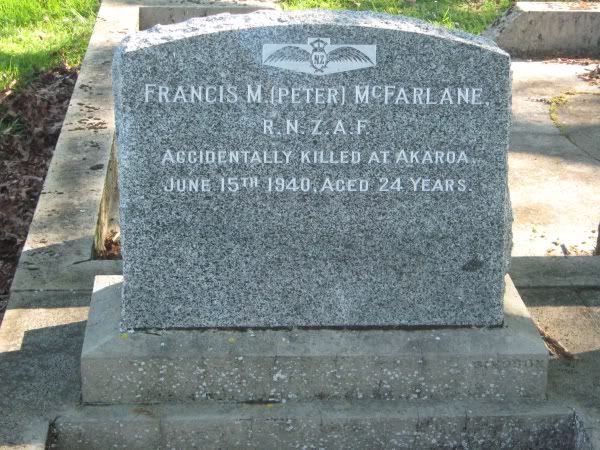 I hope you have enjoyed this thread. I am sure to come across more aviation snippets from around the region (yes, I have visited the Reid's); the next time I'm in town I shall photograph the RNZAF memorial window in Nelson Cathedral. Until then... |
|
|
|
Post by rebelp51d on Jul 20, 2021 0:11:04 GMT 12
I know this post is quite old but I just made a thread as I was curious about Nelsons Aero history, possibly as Blenheim seems to have kept it alive where here not much remains!
Really interested to find out what happened to that Messerschmit..
|
|
|
|
Post by nuuumannn on Nov 9, 2021 12:46:46 GMT 12
I know this post is quite old but I just made a thread as I was curious about Nelsons Aero history, possibly as Blenheim seems to have kept it alive where here not much remains! Really interested to find out what happened to that Messerschmit.. It was scrapped post-war in Christchurch. It was at Wigram and was offered to the Canterbury Museum, who didn't want it, so it was disposed of. There is a thread on the Bf 109 here somewhere. |
|
|
|
Post by nuuumannn on Nov 9, 2021 13:22:11 GMT 12
To revive this thread, I'll be posting the odd bit of interesting stuff of an aviation nature in and around Nelson as I find them, so if any of you are this way inclined, feel free to contribute. Yesterday I took advantage of glorious sunshine and went to explore the old RNZAF bomb dump at the southwestern corner of the airfield. There is nothing remaining on the spit itself except long grass and a few deep furrows where concrete structure has been removed. These derelict buildings are on the south side of the airport next to the weather station. They are full of unrelated junk but are clearly old RNZAF buildings. The clump of bushes to the right sits on the concrete pan of a long-gone structure.  DSC_2616 DSC_2616 During the war there was a dummy wooden Hudson fuselage located to the right of the sloping concrete ramp on the far side and here, Hudson crews carried out dinghy drills.  DSC_2618 DSC_2618The terminal from the far side of the runway.  DSC_2621 DSC_2621 This is the entrance to the spit where the bomb dump was located. I don't have a photograph of its layout, so cannot pinpoint with accuracy where anything was located. To the right of this image is the beachfront. In the distance a windsock can be seen.  DSC_2643 DSC_2643 This is the beachfront close to where I took the previous image from. For a kilometre lies the remains of the bomb dump and surrounding concrete structures.  DSC_2624 DSC_2624 The opposite end of the stretch of beach where the concrete had been dumped. Any semblance of structure has been erased, but it's fascinating to see it all in this state.  DSC_2628 DSC_2628 Of prominence are the red bricks, which litter the beachfront, some painted walls are visible here.  DSC_2633 DSC_2633 Up on the grass again, some tie-down points.  DSC_2634 DSC_2634 This is the southern end of the peninsula looking toward the airport.  DSC_2636 DSC_2636 The original airport perimeter track is still visible, the road to the spit branching off at bottom right.  DSC_2644 DSC_2644 And finally for today, Enn Eee Eff plying its trade. 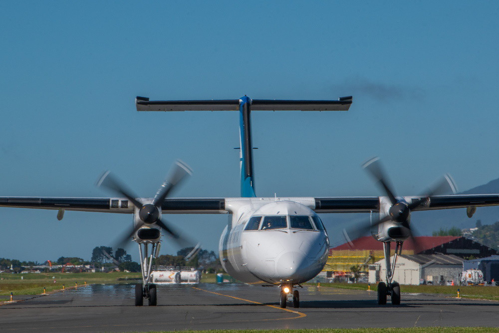 DSC_2651 DSC_2651 |
|
|
|
Post by Deleted on Nov 9, 2021 15:59:51 GMT 12
Thanks Grant, that was a fascinating virtual tour.
|
|
|
|
Post by nuuumannn on Nov 26, 2021 12:30:33 GMT 12
Yesterday, I went on another walk around Nelson airport, this time the northern end and I was accompanied by Graeme McConnell for perspective, he brought a copy of his book with him for reference. We spent more than four hours pottering about, with a stop at the Nelson Golf Club HQ for a bite to eat. My aim was to photograph the remnants of the dispersal pans at the northern end of the field, which is now a part of the golf course, so even though the public can wander around up there while strolling around the airfield perimeter, those playing golf object to it for obvious reasons, so we sought permission as well as a nice sit-down at the golf club. We began on Trent Drive outside the Air New Zealand compound and in this image we are standing directly in front of where the wireless hut was located; it was the first building erected on-site at the new airport, the aeradio hut was put up to aid the Cook Strait Airways Rapides that were operating from Stoke at the time before the new aerodrome was completed. Approximately where the big willow in the background is, was the location of one of three masts in the area, the second being in front of Hangar Two in the car park in front of the white administration building in the background. The third was out of the picture to the left where the public car park across from the new hangar is now situated.  DSC_2931 DSC_2931 We magic ourselves to the gate entrance to the airport site on Dakota Street now and we are looking at an old ex-RNZAF building that was the HQ of the Nelson Gliding Club.  DSC_2935 DSC_2935 The sign on the door betrays its former use.  DSC_2934 DSC_2934 The door was unlocked, so we took a peek inside.  DSC_2933 DSC_2933 Sadly, this obscure piece of New Zealand aviation history will one day succumb to either the elements, as this image shows, or airport renovation plans. Graeme stated that the homing pigeon society once used this end of it for whatever a homing pigeon group might need it for.  DSC_2938 DSC_2938 Behind the building butted up to the corrugated lean-to on its side was this big concrete block, the use of which we can't figure out. It could have been a base for a storage tank, but I couldn't find any mounting holes or such like once it was cleared of leaves.  DSC_2937 DSC_2937 From there we walk past the Nelson Helicopters hangar and look over the fence in the car park to what was the original access road to the original airport terminal. This road went to the left of the picture to the roundabout where during RNZAF times the flag pole was located, which is the larger grass island to the left at centre of the image. To its right in the picture was the terminal itself, now a part of the taxiway, but up close the outline of the terminal building can be seen in the concrete.  DSC_2930 DSC_2930 To the right of the picture above stood the original Hangar One, the double-domed Cook Strait Airways (CSA) hangar, which was pulled down because from the tower of the second terminal the air traffic controllers couldn't see the taxiway from the GA hangar cluster at the northern end of the airport. The building was historic as it was originally built at the Stoke site and was moved to the Quarantine Road site in 1938. In the 1990s Graeme and Richard Waugh, the dynamic duo organised a CSA reunion on the company's anniversary, which forum member Planewriting has many stories to tell about it and a particularly troublesome DH.89, which added to the rich history of the building. This image was taken airside at an earlier date when the hangar base wasn't covered in construction work detritus from the ongoing dismantling of Hangar Three, seen in a better state than it is today to the right. At this end, where the fuel tanks are located was the Nelson Aero Club bar and I'm assured there was many a riotous night had there.  DSC_2594 DSC_2594 Hangar Three is now merely a skeleton of borer-riddled beams and I was advised that it nearly blew down in the strong winds we had last week. Not immediately obvious is that the front side of the hangar has been dismantled, so there is little supporting the structure, except a few struts inside the bulding to prevent it collapsing.  DSC_2928 DSC_2928 We walk past Hangar Three and head to what used to be airside and here we are looking at what used to be the RNZAF Main Store building, now employed as a rental car detailing facility. This isn't the original location of this building, it used to sit adjacent to the roundabout next to the old terminal, to the left out of the picture posted above, but was relocated sometime after the war, possibly when the hardstanding was redone in the area, although the building's base still exists. This image was, like the previous one of the base of Hangar One, taken at an earlier time, on this spot was the Nelson Aero Club building, which was relocated at Mapua wharf, until dismantled with the intent to move it to Motueka aerodrome for inclusion of an on-site aviation museum, but its condition was so bad that the building was not reassembled.  DSC_2580 DSC_2580 Taken at the same time as the last one, this building behind the cars was the former civil air terminal during the war as the RNZAF had adopted the original terminal for its use, the building alongside it with the windsock hanging on for dear life to the rotting facade was in use as a store facility by the RNZAF. Note the hexagonal concrete slabs, a feature of the hardstanding in front of the hangars, these were designed with ease of replacement should the airfield get attacked.  DSC_2579 DSC_2579 We walk from Dakota Street in the background to the roundabout with Trent Drive branching off to the left to cross the causeway, past the maintenance hangars to the new terminal and carpark, with McLaren Road to the right toward the GA hangars.  DSC_2945 DSC_2945 In front of the black and yellow directional arrow on the roundabout is a plaque that Graeme drew my attention to. Back in 1984, he was asked by the airport company for a recommendation for a suitable name for the main road to the airport from Quarantine Road, so he suggested Trent Drive after local boy Leonard Trent and this wee factoid was, unbeknownst to almost everyone who drives past this roundabout, recorded on a plaque. I have driven past this roundabout hundreds of times on my way to and from work and during visits to the airport for one reason or another and I had no idea this plaque existed.  DSC_2943 DSC_2943There is a more recent memorial to Trent on the roadside opposite to the maintenance hangars in full view of people driving to the airport, which can be seen in the very first post of this thread. Next, the Golf club and more from the perimeter track. |
|
|
|
Post by nuuumannn on Nov 26, 2021 13:20:51 GMT 12
Next, we walk along Bolt Road to the new golf club HQ and in the foyer is this picture, which was taken in 1981. At its bottom edge is Bolt Road, with Parker's Road along the right edge and curving to the left at its top. Just before the curved section is a bridge that goes to the old Golf Club clubhouse built in 1907, which was in use at the time this picture was taken. The new golf club HQ is located at the end of Cohen Place, which is the short road off Bolt road at the bottom centre of the picture, it isn't the diagonal road, this is an access road for the motels that can be seen, which is now the access for the golf club as well, being situated adjacent to the motel building. The area we came to photograph is at top left on the golf course above the end of the runway, there were three dispersal pans and associated structures during the war, but have long since been removed to make way for the golf course. Note the two aeroplanes at bottom left, these are the Carvairs that were resident at Nelson for some years.  DSC_2952 DSC_2952 From the golf club balcony, we can see across the course to the original golf club clubhouse, which was used during the war by the 91st Light Anti-Aircraft Regiment; the associated buildings have since been removed from the site, which will be the subject of a photo sortie at a later date.  DSC_2946 DSC_2946Looking in the opposite direction toward the airport, we can see the proximity of the runway and taxiway to the golf course.  DSC_2947 DSC_2947 After lunch, we headed across the golf course to the airport perimeter track. The windsock, this image taken at an earlier time before the new terminal had been built; I didn't see the point in doubling up on images I already have. Note how prominent Hangar Three is as part of the airport's landscape. I hope the new rescue centre isn't an ugly monstrosity. 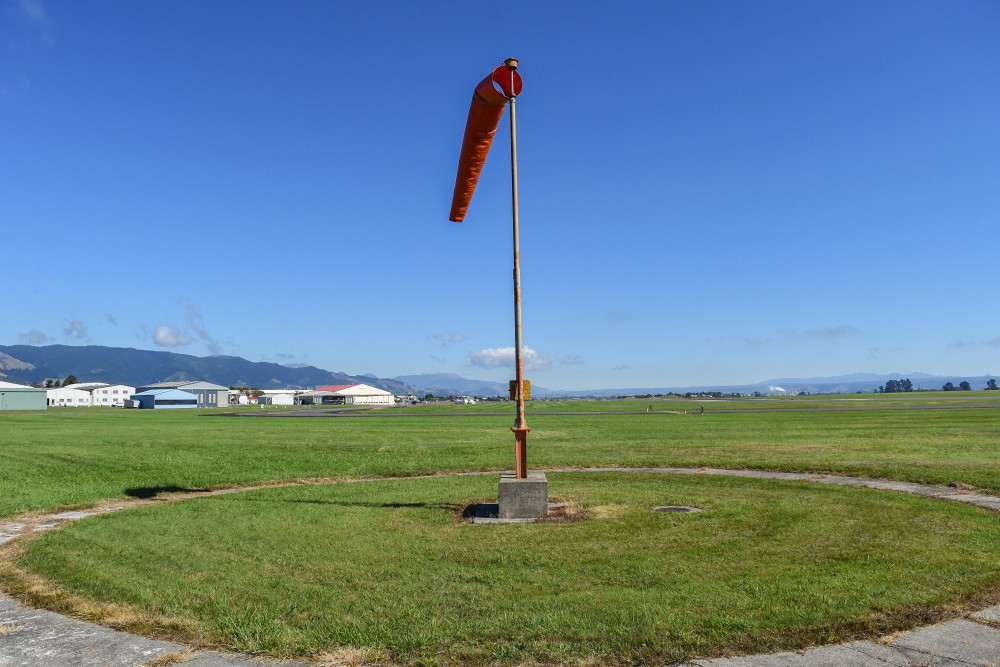 DSC_1748 DSC_1748The view now is quite different.  DSC_2954 DSC_2954 We have reached the site of the dispersal pans. This is one of them from ground level.  DSC_2958 DSC_2958From above its contours can be clearly seen. Behind this revetment, there were a few buildings including a concrete bunker at the pan's far side, but there is nothing there now as it's all been cleared out to make way for the course. 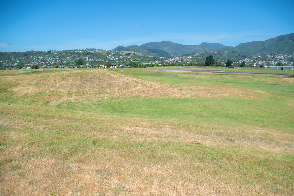 DSC_2959 DSC_2959 The second pan was located directly ahead of where I was standing, but nothing remains, the surface having been flattened to make way for the course. That's the airport perimeter fence at this section of the site, with the grass runways stretching ahead. Avsec would have a fit if they ever got a presence at Nelson.  DSC_2960 DSC_2960 The third pan from ground level is indistinguishable from a natural indent in the landscape, which I initially mistook for the revetment.  DSC_2962 DSC_2962 The revetment from the bank.  DSC_2963 DSC_2963 Lastly, Soundsair Caravan 'SAN high above us on our trek through time.  DSC_2957 DSC_2957 In this image, taken in 1942, the salient features of where we covered on our walk are noticeable. At the airport site at bottom can be seen the location of the wireless hut adjacent to the causeway across the creek, with two of the radio masts visible, the original location of the main store adjacent to the roundabout and terminal, Hangars One and Three alongside each other, with The gliding club building to the right of the main store opposite Hangar One, and the Nelson Aero Club hangar, civil terminal and store building on what is now Dakota Street. The roundabout where the original Trent plaque is located is where the road branches off in two directions. The golf club clubhouse is in the middle of the cluster of RNZAF housing buildings off Bolt Road to the right, Graeme and I discovered that one of the houses on what is now Cohen Place has a distinctive Public Works Department character about it, but we'll take a look at that part of the airport site another time. The 91st Anti-Aircraft Regiment site is at the top of the picture at the middle left, with the dispersal pans plainly visible to the left, with the building cluster visible to the right of the rightmost revetment.  Golf Club Golf Club Thanks for looking. |
|
|
|
Post by emron on Jun 4, 2022 17:47:29 GMT 12
Nelson Evening Mail, 9 May 1941.
TAHUNANUI GOLF
LINKS
POSSIBLE EXTENSIONS TO
AERODROME
CITY COUNCIL’S CONCERN
---
INVESTIGATION TO BE MADE
__
The possibility of a large part of the Nelson Golf Club’s links being used for an extension to the adjoining aerodrome at Tahunanui was discussed at last night’s meeting of the Nelson City Council when it was decided to take steps to have the matter investigated with a view to making representations to the Government to have the area preserved as a golf links. The council considered that the golf course was a valuable asset to the city and district, and the links should not be destroyed for the purposes of the aerodrome if the use of alternative property was possible.
ONE OF CHIEF RECREATIONAL
FACILITIES
Councillor S. A. Gibbs said that he felt it was his duty to bring before the notice of the council the possible threat to the existence of one of the chief recreational facilities of the city and district. He understood that a flying survey had been made of the Nelson Golf Club’s links at Tahunanui for the extension of the Nelson aerodrome. In addition to the survey, levels pegs had been driven on the links which indicated that the golf course might be practically cut in half. He believed that such an extension would provide longer runways for heavier machines than those now in use.
Councillor Gibbs said that if the links were used for aerodrome purposes as a war emergency, and if there was no alternative, then they would have to put up with what ever was done and not complain. The Government, which had provided the larger part of the cost of the new aerodrome, had purchased land to the south and south-west which he was given to understand would be used for any possible extension to the ground.
Councillor Gibbs said he was not a golfer, and was only interested in the matter from the point of view that the golf links formed a valuable asset to the city and attracted many visitors. He was pleased that only one councillor was a golfer as it would enable them as a body to have a disinterested viewpoint on his proposal. No city was up-to-date without a satisfactory golf links which formed an essential recreational amenity. If the present links were destroyed there was no other other area in the district suitable for an 18-hole golf course. No golf links in the Dominion had such a beautiful situation as those at Tahuna, and in addition they were on the land which was ideal for the purpose. If the area pegged out was levelled the links would be destroyed and could not be replaced. It was an important matter from a civic point of view. If the Tahunanui golf links were lost, the city would lose a valuable asset.
He understood that the easiest way of extending the aerodrome would be by taking part of the links. However even if adequate compensation was paid for the land nothing could compensate for the loss of the links. There was much more to be considered than a number of people being deprived of a recreational facility....
|
|
|
|
Post by nuuumannn on Jun 5, 2022 10:32:46 GMT 12
|
|
|
|
Post by nuuumannn on Jun 5, 2022 10:38:29 GMT 12
An addition to my walkabout with Graeme, as we know from the pictures above, Hangar 3 is now gone, and the former Nelson gliding club building along with it. All that remains from the building we photographed is the heavy concrete base we took a picture of that sat around the back of the building. There are rumours afoot of other, rather substantial changes to NSN that will see the destruction of more historic fixtures on site. Ah, progress...
|
|
|
|
Post by davidd on Jun 5, 2022 13:25:15 GMT 12
A real Tour de Force Grant, of an airport that I saw lot of in my youth (1950s) but scarcely ever physically set foot on till many years later, and in fact I have no memories of landing there in the 1950s. However I DO vaguely recall growling along in the South Island Airways Dominies from Harewood to Nelson in those all but forgotten years, cruising northwards up the coast at a few thousand feet, but I was later reminded that many times the aircraft never made it through to Nelson anyway due to bad weather, and air sickness was frequently suffered en route. Also do remember the very strong perfume used at Harewood by (presumably) the female staff - there were no such people aboard Dominies though, just a pilot up front, and up to six passengers. We spent our Christmas holidays there every year for about 7 years, from about 1954 or 1955 onwards, but later switched to the railcars so that we could actually get there on time for once (by bus of course, never a railway line to Nelson). However I do recall that I enjoyed the sound of those old Gipsy Queen Mk. IIIs purring away, nicer sound than those engines in the FIAT railcars, despite their reliablilty (cannot ever recall a breakdown).
|
|
|
|
Post by emron on Jun 5, 2022 18:21:54 GMT 12
Nelson Evening Mail, 26 August 1944.
NELSON AERODROME
FUTURE NEEDS OF AVIATION
____
EXTENSIONS MAY INVOLVE
GOLF LINKS PROPERTY
____
HARBOUR BOARD’S INTEREST
___
Believing that extensions to the present Nelson aerodrome runways will be necessary to provide facilities for the larger planes of the future, the Nelson Harbour Board has decided to take steps to acquire adjoining property, which happens to be part of the Tahunanui golf links.
Prior to its occupation by the Air Force during the war the aerodrome was controlled by the Nelson Harbour Board as the local Airport Authority. It was in this capacity that the Board made its recent decision. Although there is no certainty that the Board will resume control of the aerodrome after the war it is logical to presume that the board would again become the authority if the Government decided to relinquish control after the war.
Some time ago the Public Works Department requested the board to make an assessment of its capital interest in the aerodrome but the reason for that request was not stated, though it was suggested from some quarters that the Government intended to buy out the Board’s interest and take over the control.
In the construction of the aerodrome and its extension for use by the Air Force only a small area of two thirds of an acre was taken by the Public Works Department from the original golf links property (which was owned by a company). However while the aerodrome was occupied by an operational squadron part of the golf links was taken over temporarily as a dispersal area for Hudson bombers which were used for reconnaissance purposes. Negotiations have taken place recently between the company and the Public Works Land Purchase Officer for a cash settlement in respect of the occupancy and damage to that area, and it is understood that that settlement is likely to be completed at an early date, which would allow the golf links company to resume the whole of its former area with the exception of the two-thirds of an acre already incorporated in the aerodrome.
The question of the golf links being taken over permanently by the Public Works Department has never arisen.
STATEMENT BY BOARD CHAIRMAN
“The intention of the board is to take steps now to secure the right to take an area of land which might become necessary at a later date for extensions to the aerodrome to meet the needs of future aviation in Nelson,” said Mr. A. Gould, chairman of the Nelson Harbour Board when interviewed to-day. “The board’s motion passed at the last monthly meeting referred specifically to that portion of the golf links property adjoining the aerodrome at the northern end which has been used as a dispersal area for Air Force planes, and also any other portion of the property considered desirable to meet the future needs of the aerodrome. It is possible, and indeed probable, that the use of heavy transport planes after the war will require the provision of even larger runways than those now available at the Nelson airport, and the board considers it would be wise to move now to secure the right to take over any additional land which would be in the interests of the Nelson Airport Authority.”
Mr. Gould said he felt sure that as long as the board was certain of getting the extension of runways which the board believes it is likely to want, the Airport Authority would be satisfied if those extensions went on the southern end instead of the northern end. The board had no desire to interfere with what was regarded as a valuable asset to the province (the golf links) but felt that it would be failing in its duty if it did not take every step considered necessary for the future development of aviation.
____
Nelson Evening Mail, 17 October 1944.
NELSON AERODROME
___
FUTURE REQUIREMENTS
___
ADJOINING GOLF LINKS
PROPERTY
___
OPINION OF GOVERNMENT
DEPARTMENTS
___
The opinion that while the land adjoining the Nelson aerodrome remained in use as a golf links it was unlikely that any action would required to protect the interests of the aerodrome for any future extensions, was expressed in a letter received at last night’s meeting of the Nelson Harbour Board from the Minister in Charge of Civil Aviation (Mr. F. Jones).
The Minister’s letter was as follows:
“I have to advise that the matter has now been reviewed by the departments concerned and the following is the considered opinion of both the Public Works and Air Departments:
“Extensions to the existing flying field at Nelson are not considered necessary to cope with the immediate post-war aviation requirements. The very considerable extensions to the field which were constructed to meet the requirements of the R.N.Z.A.F. should meet the requirements of local airlines serving Nelson district.
‘So long as the land adjoining the aerodrome remains a golf links it is unlikely that any action will be required to protect the interests of the aerodrome for any possible future extensions. The attitude of the Club in insisting that the property be restored to its original condition and purpose after utilisation as an aircraft dispersal area, rather than sell the land to the Government, indicates that the club’s policy is to hold this land as a golf links and that it has no intention of disposing of the property for sub-divisional purposes. There would therefore, be little purpose in the Harbour Board acquiring this land.
A golf links is almost an ideal purpose to which land adjoining an aerodrome could be put. In the event of any indication that the land is likely to be subdivided or built on, a proclamation restricting the height of obstructions to be erected on the whole or part of the golf links property could be readily gazetted.’
“In the foregoing extracts from departmental reports I think that you will agree that it is a reasonable view to take that the matters raised in your letter are already adequately covered and possible future requirements reasonably safeguarded.”
|
|
marconn
Leading Aircraftman

Posts: 5
|
Post by marconn on Mar 23, 2024 20:26:50 GMT 12
To revive this thread, I'll be posting the odd bit of interesting stuff of an aviation nature in and around Nelson as I find them, so if any of you are this way inclined, feel free to contribute. Yesterday I took advantage of glorious sunshine and went to explore the old RNZAF bomb dump at the southwestern corner of the airfield. There is nothing remaining on the spit itself except long grass and a few deep furrows where concrete structure has been removed. These derelict buildings are on the south side of the airport next to the weather station. They are full of unrelated junk but are clearly old RNZAF buildings. The clump of bushes to the right sits on the concrete pan of a long-gone structure.  DSC_2616 DSC_2616 During the war there was a dummy wooden Hudson fuselage located to the right of the sloping concrete ramp on the far side and here, Hudson crews carried out dinghy drills.  DSC_2618 DSC_2618The terminal from the far side of the runway.  DSC_2621 DSC_2621 This is the entrance to the spit where the bomb dump was located. I don't have a photograph of its layout, so cannot pinpoint with accuracy where anything was located. To the right of this image is the beachfront. In the distance a windsock can be seen.  DSC_2643 DSC_2643 This is the beachfront close to where I took the previous image from. For a kilometre lies the remains of the bomb dump and surrounding concrete structures.  DSC_2624 DSC_2624 The opposite end of the stretch of beach where the concrete had been dumped. Any semblance of structure has been erased, but it's fascinating to see it all in this state.  DSC_2628 DSC_2628 Of prominence are the red bricks, which litter the beachfront, some painted walls are visible here.  DSC_2633 DSC_2633 Up on the grass again, some tie-down points.  DSC_2634 DSC_2634 This is the southern end of the peninsula looking toward the airport.  DSC_2636 DSC_2636 The original airport perimeter track is still visible, the road to the spit branching off at bottom right.  DSC_2644 DSC_2644 And finally for today, Enn Eee Eff plying its trade.  DSC_2651 DSC_2651 |
|
marconn
Leading Aircraftman

Posts: 5
|
Post by marconn on Mar 23, 2024 20:45:01 GMT 12
Liked your photos of the airport spit where the old bomb dump was, spend loads of time hunting around there collecting bricks which my parents used to landscape their garden with. Took thousand home. All came from the demolished old nelson post office.
The small huts were originally radio beacon huts that were down on the spit, but were later moved. There was a substantial radio building down there till about 1985, full of radio equipment, also a very large windsock.
There were distinct roads, and the area was mown to keep from becoming a fire hazard.
The bomb dump had obvious revetment shapes and each was accessed of the main entry road. All bulldozed now.
There were also Anti aircraft gun sites along the shore, found some live shells once. The aircraft wrecked in the 1944 storm were supposed dragged over to the spit and burned, then buried, this would have been hawker harts, vincents , vilderbeasts.
There was a bombing target range on the sandbank opposite in the blind channel. Used to fish up practice smoke bombs about 2 foot long in the snapper net sometimes.
We used to live in what is now cohen place off bolt road, then it was 66 bolt road, 66 and 68 was the old sergents mess that had been cut in half and turned in two houses. These house were all used by personel from Ministry of transport , Traffic cops, crash fire, airways controllers, Meterological Service. The old war time base used to surround the area, were a few old huts in back yards still, one up until recently behind the Roto street store. I can remember playing around in the two previous airport terminals.
|
|


